
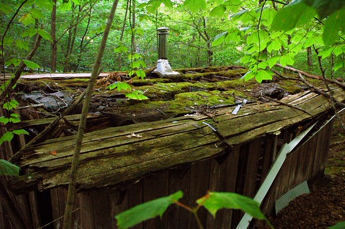
Abandoned Cabin, Cross Village MI, photo by Latitude 45
Flickr (where most of the photos seen here on Michigan in Pictures reside) has recently added a nifty feature that allows you to view a map of all photos in any pool. Try the Michigan Pool and the Absolute Michigan pool for example. It also works on tags like michigan or lighthouse. Here’s where Flickr explains how geotagging works (apparently you can do it without carting around a GPS unit)
Very cool.
You can also view maps of whole sets of photos. Click the pic below to view the locations of more photos of this cabin and the rest of the photos in Martin’s “Abandoned” set.


If you prefer Google Maps for mapping your photos via drag and drop interface, our project, Panoramio, may be interesting for you. Btw, you can later watch the photos in Google Earth KML feed, a much better experience than web based maps.
Eduardo
LikeLike