#TBT Fortress of Solitude Edition at the Grand Island Ice Caves

Grand Island Ice Cave

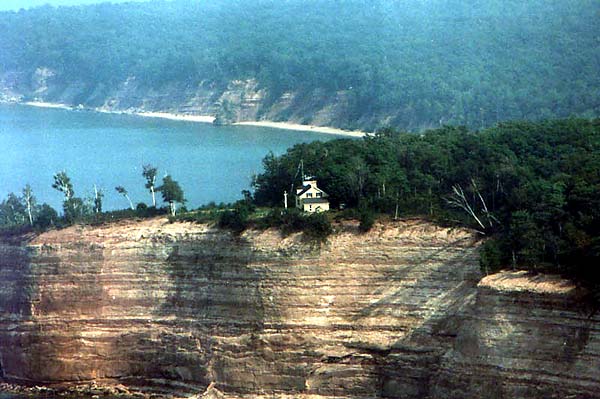
Grand Island ice cave, Winter 2012/13, photo by Ash W Photography

A cool site that really gives you to tools to have a lot of fun in the Upper Peninsula is Things to Do in the U.P. #64 is visiting the Grand Island Ice Caves. After providing very detailed tips & information about how to get to these spectacular formations on Lake Superior off Munising, Brian Marticcui writes (in part):

For an intimate look at nature’s awesome power, sidle up to one of the columns and peer into its core. Expecting a solid tower of frozen water? Not a chance. These columns, especially the newer and/or sun-exposed ones, are actually made up of tiny beads and icicle-like formations separated by vertical channels that allow water to pass through them. It’s one of those mind-numbingly complex natural things that’s simultaneously random and orderly – kind of like a geode, but mostly frozen and not quite as colorful.

Inside, things are a bit more stable – and a whole lot more interesting, if that’s possible. For starters, many of the “entrances” to the caves are little more than elevated holes between solid ice columns. Depending on how the caves have set during the weeks leading up to your visit, you may have to scramble up a mound and squeeze yourself through an opening to actually gain access. (Clip-on crampons might be a good idea.)

Once you get in, be careful, both for your own physical safety and for the integrity of the caves themselves. The floors are often mirror-smooth, making regular walking a major challenge. Meanwhile, the ceilings can be low and/or spiky, and some of the most intricate formations – the fuzzy, mold-like bits of “shaved” ice that project from the bare rock of the walls and ceilings – are extremely fragile. Don’t be the guy or girl who ruins a particularly awesome formation for everyone else – those things don’t reform in their original states.

Since the caves’ outer walls aren’t comprised of a single, solid curtain, and blockages abound, you’ll have to enter and exit several times to get the full measure of their interior spaces. Be careful each time you do; in particular, don’t lean on any dubious-looking columns. Ice is heavy, and you’ll probably see the chilling remains of spectacular collapses. You don’t want to be under an unsafe formation when it goes.

Read on for much more and also follow Jesse’s Things to Do in the U.P. on Facebook.

Ash took this shot at Grand Island’s ice caves a couple of years ago. View it bigger on Facebook and see more of her work in her Upper Peninsula of Michigan gallery at ashwphotography.com.

PS: If you’re in the Marquette area, Ash be displaying February 17 through the end of March at Sweet Water Cafe in Marquette from Feb 17th to the end of March, just a few doors down from Zero Degrees Artist Cooperative where she has her work.

PPS: For a little discussion on current conditions on the crossing to Grand Island, see this thread on Facebook, and before you go be sure to talk to someone who knows something about it. Feel welcome to use that advice for anything that’s possibly dangerous that you know little about.

Grand Island’s North Shore

Remote Lake Superior by Lake Superior Photo

Grand Island, North Side, photo by Lake Superior Photo

The Grand Island National Recreation Area is located on Grand Island off the coast of the U.P. just west of Munising. The island is accessible by private boat or ferry and features cliffs like those in the Pictured Rocks, with some as high as 300 feet! There’s a hiking/biking trail around the island, but Shawn says this location is probably only accessible by boat.

You really should check this shot out background bigtacular on Facebook. There’s lots more great pics in Lake Superior Photo’s amazing gallery too. Do yourself a favor and follow Shawn & Lake Superior Photo if you’re not already and purchase prints online or in her gallery & studio in downtown Marquette!

More summer wallpaper on Michigan in Pictures.


Murder Mystery at Grand Island North Light

Grand Island North Light by Jeff Shook

Grand Island North Light, photo by Jeff Shook

The photo above is from the Grand Island North Light page at Terry Pepper’s Seeing the Light. Head over there for all kinds of information about one of Michigan’s lonelier lighthouses.

As Halloween is tomorrow, I thought I’d share the tale of a mysterious murder at North Light from the Center for U.P. Studies at Northern Michigan University.

On June 12, 1908 the body of 30-year old Edward S. Morrison, the assistant lightkeeper at North Light, was discovered in a small sailboat near Au Sable Point. Although identification took a while, since few of the local people knew him, it was definite once made. Morrison had a distinctive tattoo of thirteen stars on his left arm, leaving no doubt as to the identity of the remains. Initial reports said his head had been “battered almost beyond recognition” and that “the head and shoulders were fearfully crushed, as if battered by a club.” Inexplicably though, a coroners jury concluded death was due to exposure, thought to be caused by the rough weather on the 7th. A reported second coroners jury also examined the evidence and returned a verdict that the members were not able to tell how he died, but they had a strong suspicion of murder!

Morrison had been assistant keeper only six weeks when he met his death. A native of Tecumseh, Michigan, he joined the Lighthouse Service on May 1, 1908 and secured the assistant keeper’s appointment at North Light. Friends claimed he had a “bright and sunny disposition” and that he “didn’t have an enemy in the world.”

The keeper of the light was George Genery, a long-time veteran of the Service. Appointed to North Light in 1893, he had been the assistant keeper at Menagerie Island, Isle Royale from 1887 until his posting to Grand Island. It was later claimed he had trouble keeping his assistants since none lasted longer than a season. Working with Genery was said to be difficult at best. The keeper was in Munising on June 6 to get supplies.

Baffled by the discovery of Morrison’s body and the knowledge that the beacon had been dark for nearly a week, a delegation from Munising went out to the light. They discovered the supplies Genery had brought back from Munising still piled on the dock. An empty wheel barrow stood nearby and his coat dangled undisturbed on a hook in the boathouse. Morrison’s vest was hanging carefully on the back of a chair, his watch and papers safe in a pocket. Of the three boats normally kept at the station, reports differed whether two or only one was missing. The last official log entry was made on June 5, while the slate entry for the 6th was made in Morrison’s hand. Neither gave a clue to anything being amiss. Other than the untended lamp, all else was normal, without evidence of any unusual occurrence. Local volunteers manned the light until the service send a replacement.

Authorities immediately started a search for the missing keeper, but he had completely dropped out of sight. There were reports that five different men had seen him at various times in Munising between June 9 and 12, and that he was drinking heavily. His wife, living in town, claimed no knowledge of his whereabouts and did not seem overly concerned with his strange disappearance.

There were several theories proffered to explain the case. One said the two men had gone out to lift nets and that Genery had fallen overboard and drowned. Morrison, unfamiliar with a sailboat, then drifted about helplessly until finally perishing from exposure. Friends, however doubted such reasoning. They considered Morrison an expert sailor, and in fact he had previously owned a 32-foot sailboat on the Detroit River.

Another theory is based on their having been paid on the 6th; that they were attacked by one or more unknown assailants on the island, murdered, robbed and the bodies dumped into the sailboats and cast adrift. Morrison’s eventually made shore. Genery’s never did. Lonely to distraction, no better location for such a crime could be imagined. No one else was in the area to witness such a heinous deed. The nearest other occupant on the island was the Cleveland Cliffs game keeper, whose house was seven miles to the south. There was a story that a body was later discovered in the east channel, but it was apparently never identified so whether it was the missing keeper is unknown. Finding “floaters” was not that unusual, so no definite link between it and Genery was possible.

The third theory was that Morrison was murdered by Genery…

Read on for more and also have a look at Death at the Lighthouse by Loren Graham as reviewed by the Moonlit Librarian.

The photographer is Jeff Shook of the Michigan Lighthouse Conservancy, an organization that does great work in the preservation of Michigan’s lighthouses.

Grand Island National Recreation Area

Grand Island's North Shore

Grand Island’s North Shore, photo by Rudy Malmquist

Whereas Pictured Rocks Day is this Saturday and whereas this blog loves the Pictured Rocks National Lakeshore, I’ve decided to dedicate the week to posting about one of my favorite areas of Michigan. ;)

Wikipedia explains that the Grand Island National Recreation Area is part of the Hiawatha National Forest. The 13,500-acre island is about 8 miles long and is located about a mile off the Lake Superior shore at Munising. Congress made the island a National Recreation Area in 1990 after the U.S. Forest Service purchased it from the Cleveland Cliffs Iron Co.

Grand Island’s geology is an extension of the sandstone strata of the adjacent Pictured Rocks National Lakeshore. Island sandstone cliffs as tall as 300 feet (91 m) in height plunge down into the lake. A 23-mile (37 km) perimeter trail skirts much of the island’s shoreline.

Native Americans quickly found the fisheries around Grand Island to be a resource for seasonal and year-round living. Artifacts from as early as 3300 years before the present (1300 BCE) have been found.

Grand Island National Recreation Area is served during summer months by a tourist ferry and island tour bus. The ferry ride, which is less than 1 mile (1.6 km) long, shuttles between a dock on M-28, northwest of Munising, and Grand Island’s Williams Landing. Ticket fees and an admission fee to the island are charged. During the summer months, the ferry makes several trips to the island each day.

Also see the Forest Service site for Grand Island, a Google Map of the island and the Grand Island Ferry Service which has all kinds of recreation information including the fact that the island has bike-friendly roads & trails! Here’s a video of that gives a taste of biking there, and definitely check out frequent michpics photographer Nina Asunto’s blogs about Grand Island for an in-depth look at this island.

I’m pretty confident that the biking drew Rudy to the island. Get the photo big as Superior and see more work from Rudy in his slideshow.

See the Grand Island North Lighthouse, the Grand Island East Channel Light and more Michigan islands on Michigan in Pictures.