High above Houghton, Michigan

Houghton Michigan

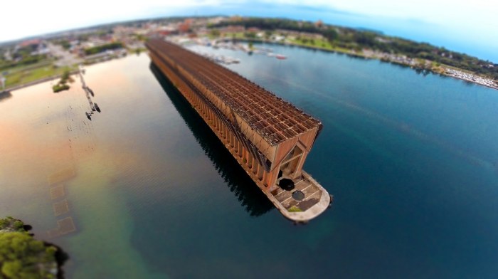
goodnight, pretty little town, photo by brockit, inc.

This wonderful photo made me want to know more about Houghton, Michigan, so here’s an edited profile of Houghton via Wikipedia:

Houghton is located on the south shore of Portage Lake, across from Hancock. (see map) Native Americans mined copper in and around what would later be Houghton thousands of years before European settlement. French explorers had noted its existence in the area as early as the seventeenth century, and in 1772 Alexander Henry had prospected for copper on the Ontonagon River near Victoria. When Horace Greeley said, “Go West, young man” he wasn’t referring to gold, but rather the copper rush in Michigan’s western Upper Peninsula.

The city is named after Douglass Houghton, physician-naturalist on Henry Rowe Schoolcraft’s Lake Superior expedition whose 1841 report on the quantity and superior qualities of UP copper earned him the title of “father of copper mining in the United States.” The news brought many Cornish and Finnish immigrants to the area, along with smaller numbers of French-Canadian immigrants arrived in Houghton (or Copper Island as they called it) to work in the copper mines. These groups have had and continue to have a great influence on the area’s culture and cuisine.

In Houghton’s first days it was said that “only thieves, crooks, murderers and Indians” lived there. The post Civil War boom and increasing demand for copper wiring fueled the development of Houghton in the 1860s and 1870s. The Keweenaw Waterway, a dredging and extension of the Portage Lake, the Portage Shipping Canal and Lily Pond that turned the northern part of the Keweenaw Peninsula into “Copper Island” was completed in 1873. By 1880 Houghton had become “a burgeoning city” and in 1883, the railroad was extended from Marquette.

The last nearby mines closed in the late 1960s, but in 1885 the Michigan State Legislature foundedthe Michigan College of Mines to teach metallurgy and mining engineering. The school continues today as Michigan Technological University – the primary employer in the city.

Houghton has the distinction of being the birthplace of professional ice hockey in the United States when the Portage Lakers were formed in 1903, and Houghton’s Dee Stadium (formerly the Amphidrome) is the home of the Portage Lake Pioneers Senior Hockey Team.

Click for more from Wikipedia and please feel free to share tidbits in the comments.

View Adam’s photo background bigilicious on Facebook and definitely follow brockit for tons more cool photos!

More Houghton on Michigan in Pictures.

Sailor’s Delight on Crispell Lake

Sailors Delight

Sailor’s Delight, photo by Maury Page

Maury shares:

This photo was taken at Crispell Lake in Clarklake, MI on a calm, summer evening. I couldn’t capture the sun rays from where I was standing, so it seemed like a perfect opportunity to get out my new drone. There were only a couple boats on the lake and it was a nice quiet night. When I was capturing this scene it just so happened that a bird flew into the frame at the perfect moment.

Regarding Crispell Lake, Lake Link says:

Crispell Lake is located in Jackson County, Michigan. This lake is 82 acres in size. It is approximately 25 feet deep at its deepest point. Anglers can expect to catch a variety of fish including Black Crappie, Bluegill, Brown Trout, Grass Pickerel, Largemouth Bass, Sunfish, Walleye and Yellow Perch.

View Maury’s photo bigger,  check out more on his Instagram at mopage19 and also on his website.

More lakes on Michigan in Pictures.

Above Frankfort Harbor

Above Frankfort Harbor

Frankfort Harbor, photo by Julie

My friend Enrico of Traverse Today and his sons shared a great aerial video from Frankfort the other day:

Julie took this stunning shot last Saturday. View her photo bigger and see more in her Drone shots slideshow.

Lots more from Frankfort on Michigan in Pictures.

Breaking Free at Tahquamenon Falls

Tahquamenon Falls aerial view

Aerial View, photo by Julie

Julie got this cool shot of the Tahquamenon Falls throwing off winter’s grip at the beginning of the month. Now it looks like winter is going to strike back. Via the Detroit news and Sara Schultz, meteorologist with the National Weather Service in White Lake, a winter storm is arriving today:

“We’re looking at the heaviest snowfall north of Saginaw, in the Thumb area and then to the north and west of that, and then of course the lower northern Michigan areas, where they could see six-plus inches of snow.”

A winter storm watch will be in effect Wednesday morning through early Thursday evening for areas north of Interstate 69, Schultz said.

“We’re looking at areas south of I-69 as mostly rain,” she said. “Between Flint and Saginaw, we’re looking at accumulation of snow and ice; just some light accumulation.”

Schultz cautioned that the forecast remains flexible as the storm enters the state. “That rain/snow line along I-69, if it shifts just a little it could throw off everything,” she said.

View Julie’s photo bigger and see more in her 366/2016 slideshow.

More Tahquamenon Falls on Michigan in Pictures.

The Colors of Omena

The Colors of Omena

The Colors of Omena, photo by Elijah Allen

Here’s a shot by a friend taken just north of me showing the incredible fall color that’s still out there along the Lake Michigan coast. It was taken from off Omena Point at the northern part of the Leelanau Peninsula, so how about a little Omena history courtesy the Omena Historical Society?

The Omena settlement had its beginnings when Aghosa Indians started arriving in 1850. In 1852, the Reverend Peter Dougherty and a band of Ottawas and Chippewas led by Chief Ahgosa moved from the present-day Old Mission Peninsula to a beautiful little bay on the Leelanau Peninsula’s eastern side. Chief Shabwasung and his Ottawa band were already encamped on the point to the north of the bay, on land Chief Ahgosa and his families from Old Mission had purchased. Ahgosa settled a little to the north, and his village became Ahgosatown. Both bands became part of the New Mission, soon to be called Omena.

Young George A. Craker came with Dougherty and taught farming to students in the mission school, and he and his descendants became active workers in Dougherty’s Grove Hill New Mission Church. Now called the Omena Presbyterian Church, it was dedicated in 1858 and has stood as the oldest Protestant Church in Leelanau County and one of the oldest historical landmarks in Northern Michigan. The Ahgosa family was also very active and some are now buried in the mission cemetery.

Click through to read more and for some historical photos of Omena.

View Elijah’s photo bigger on Facebook and scroll though when you get there for more!

More aerial photos, more history and more Leelanau on Michigan in Pictures.

Marquette Lower Harbor Ore Dock

Marquette Lower Harbor Ore Dock

Lower Harbor Ore Dock, photo by Rudy Malmquist

Travel Marquette shares the story of the Iron Ore Dock in Marquette’s Upper Harbor is also known as the Presque Isle Dock.

The dock was built in 1911 and is still commercially active. Each year approximately 9.5 to 10 million tons of ore are shipped from this dock. The dock is owned and operated by the Cliffs Natural Resources. This steel-framed dock is 1,250 feet long and 60 feet wide, with the top deck sitting 75 feet above the water level. It contains 200 pockets, each of which has a capacity of 250 tons of ore, for a total storage capacity of 50,000 tons. Supporting the dock is a foundation of 10,000 wooden piles enclosed by a 12-inch thick timber sheet plank wall filled with sand.

After being mined the ore is crushed and the iron separated out with either a chemical or magnetic process. The iron is combined with a binding agent (a glorified cornstarch) and rolled into small balls roughly an inch in diameter. The balls are fed through a kiln and fired by temperatures exceeding 2,000 degrees F. The result is Taconite Pellets which are loaded on the ore boats and shipped. Most of the pellets shipped from the Presque Isle dock go to Algoma Steel in Sault Ste. Marie, Ontario the largest integrated steel mill. These pellets, which are roughly 70% iron, will be combined with coke and limestone at the mill to make steel.

The ore comes to the dock via railcars and is dumped into steel “pockets” or bins beneath the tracks. To load the boat, the chute is lowered to the open cargo hatch and a door at the bottom of the pocket opens, allowing the pellets to run into the boat shown in the picture. Loading time is variable, depending on the size of the boat and how prepared the dock is to load. Four hours is typical. Loading is the responsibility of the First Mate. It is important to load the ore in a proper sequence to avoid over-stressing the boat unevenly. Each chute (or drop of ore) is about 20 tons.

View Rudy’s photo big as the sky and see more in his slideshow.

More Marquette and more aerial photography on Michigan in Pictures.

Way above the Mighty Mac

Mackinac Bridge from Above

The Mackinac Bridge, photo by FotoLense

Well while we’re up in the air (see yesterday) why not stay there?

View this photo background bigtacular and see more including some more aerials from the area in FotoLense’s Mackinac Island July 2013 slideshow.

There’s some great facts about the Mackinac Bridge if you click the photo and a ton more on the Mighty Mac from Michigan in Pictures!

#TBT: Tahquamenon Falls Aerial View, postmarked 1948

Newberry MI UP RPPC Aerial View Upper Tahquamenon Falls near Whitefish Point LL Cook K-498 Postmarked 1948

Aerial View Upper Tahquamenon Fall, Postmarked 1948, photo by Don…The UpNorth Memories Guy… Harrison

In honor of the latest kayaker to throw caution to the wind (or is that water?) and take the plunge over the 51′ Tahquamenon Falls, here’s a cool aerial of the Falls that was postmarked in 1948 and probably taken a few years before.

If you want to see how to do this, check out a great video feature at YooperSteez on How to Kayak Over Tahquamenon Falls with Brazilian extreme kayaker Marcelo Galizio. Things To Do in the UP has an interview with Marcello as well. NOTE: I’m pretty sure this is against the rules at Tahquamenon Falls State Park and probably a great way to kill yourself if you don’t know what you’re doing!

View Don’s photo big as the Falls and see more pics & postcards from Tahquamenon and also follow him at UpNorthMemories on Facebook.

Lots more about Tahquamenon Falls on Michigan in Pictures!


#TBT: Frozen Straits

Mackinac Bridge

Mackinac Bridge, photo by Mark Miller

OK, we’re not throwing back too far for this Thursday, but I wanted to share a really cool view that Mark took this February of the Mackinac Bridge and the Straits of Mackinac locked in the grip of the Polar Vortex.

View his photo bigger and see more great views of Michigan from above in his Aerials slideshow. You can also see one of his aerial photos of the Straits from last August on Michigan in Pictures.

There’s more aerials and more Mackinac Bridge on Michigan in Pictures!