

Sunrise at Harrisville Harbor, photo by jacalynsnana.
Michigan’s northeastern shore bills itself as the “Sunrise Side”, and this photo of dawn at the harbor of Harrisville, Michigan certainly illustrates why.
Sunrise at Harrisville Harbor, photo by jacalynsnana.
Michigan’s northeastern shore bills itself as the “Sunrise Side”, and this photo of dawn at the harbor of Harrisville, Michigan certainly illustrates why.
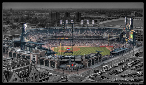
Ryan says that this is a shot of Comerica Park from the top of the abandoned David Whitney Building in downtown Detroit. He desaturated the areas around the stadium to give the structure some pop.
You can also view the original and view this photo large and on black
| Lay aside your cloak, O Birch-tree! Lay aside your white-skin wrapper, For the Summer-time is coming, And the sun is warm in heaven, And you need no white-skin wrapper!”Thus aloud cried Hiawatha In the solitary forest, By the rushing Taquamenaw ~from The Song of Hiawatha |
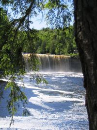 photo by Allan M |
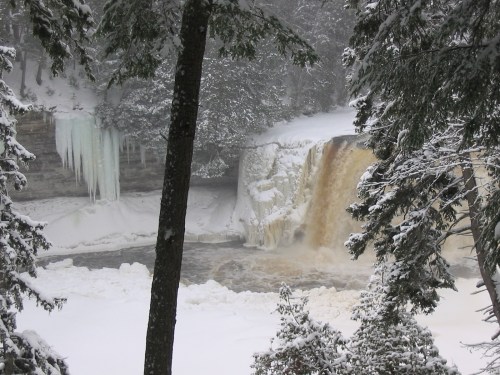
Tahquamenon Falls, U.P. Michigan, photo by by Bluejacket.
Blue Jacket, who took the above photo of Michigan’s largest waterfall in May of 2005, writes:
Located in the Upper Peninsula in Michigan, these are the upper falls. This is the land of Longfellow’s Hiawatha. Hiawatha built his canoe “by the rushing Tahquamenaw”. The amber color is caused by tanin leached from the Cedar, Spruce & Hemlock in the swamps drained by the river.
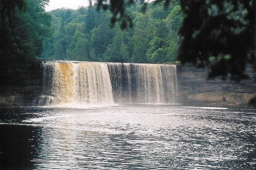
Tahquamenon Falls – Upper Falls, photo by heidigoseek.
Heidi’s pic from September of 2005 seems evocative of the solitary forest.
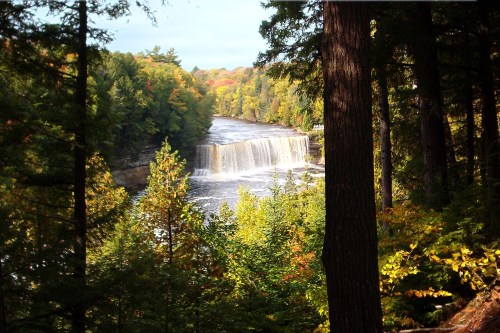
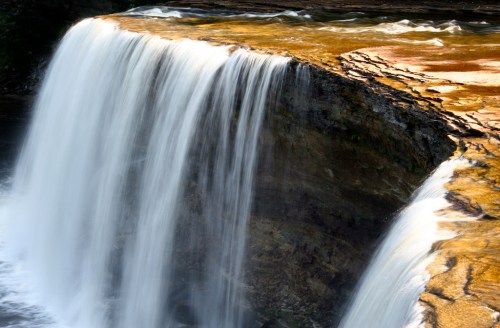
Upper Falls, photo by jamierytlewski.
Upper Falls is one of a set of pics of the Upper and Lower Tahquamenon Falls taken in February of 2005 by Jamie Rytlewski.
The DNR has a page for Tahquamenon Falls State Park but Exploring the North’s page seems a lot more welcoming and says:
The Upper Falls is one of the largest waterfalls east of the Mississippi. It has a drop of nearly 50 feet and is more than 200 feet across. A maximum flow of more than 50,000 gallons of water per second has been recorded cascading over its precipice.
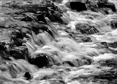
Upper Tahquamenon Falls, photo by gsgeorge.
In dry times, as Geoffrey George writes, the water can be little more than a trickle.
Here’s a link to more Tahquamenon Falls photos & information from Michigan in Pictures (also see the waterfall tag).
Ocqueoc Falls, originally uploaded by argusmaniac.
What can I say? Stunning.
According to his web page (where some very cool black & white photos can be found) argusmaniac aka Mark O’Brien is a photographer, “somewhere between advanced amateur and semi-professional” who also collects Argus cameras. The photo was scanned from black & white slide and taken in July of 2002.
goWaterfalling.com (a super-cool site for waterfall lovers) says:
Ocqueoc Falls is the only “major” waterfall in Michigan’s lower peninsula. In rockier, hillier parts of the world this would be a nameless rapids of no note but here in the farmlands and forests of Michigan it merits its own little park. The falls is at most 5 feet high. There is a small gorge below the falls, with rocky walls about 20 feet high. The Ocqueoc Falls State Forest Campground is just across the road, and the Bicentennial Pathway passes by the falls.
The falls is about 10 miles northwest of Onaway, the nearest city. From Onaway head east on MI-68, take a left onto Millersburg Road, and then a right onto Ocqueoc Falls road. According to my road atlas, Rainy River falls is about 6 miles to the east, but it is apparently on private property. I imagine it is similar in size and appearance to Ocqueoc Falls. (view on the Waterfalls of the Great Lakes Region site)
