Manabozho and His Toe … and his waterfall

Manabezo Falls.

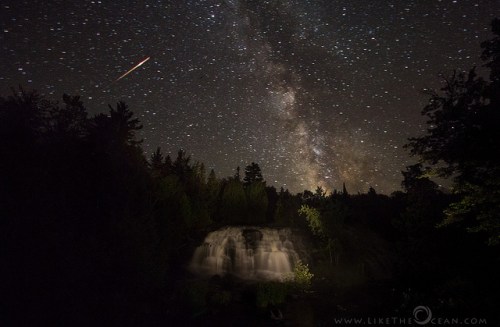
Manabezo Falls., photo by one lost backpacker

The stories of the people native to Michigan are among my favorite. One reason is for the pervasive humor that enriches them. Manabozho was definitely a trickster, one of four divine brothers in Algonquin tales. Via the Literature Network, here’s Manabozho and His Toe:

Manabozho was so powerful that he began to think there was nothing he could not do. Very wonderful were many of his feats, and he grew more conceited day by day. Now it chanced that one day he was walking about amusing himself by exercising his extraordinary powers, and at length he came to an encampment where one of the first things he noticed was a child lying in the sunshine, curled up with its toe in its mouth.

Manabozho looked at the child for some time, and wondered at its extraordinary posture.

“I have never seen a child before lie like that,” said he to himself, “but I could lie like it.”

So saying, he put himself down beside the child, and, taking his right foot in his hand, drew it towards his mouth. When he had brought it as near as he could it was yet a considerable distance away from his lips.

“I will try the left foot,” said Manabozho. He did so and found that he was no better off, neither of his feet could he get to his mouth. He curled and twisted, and bent his large limbs, and gnashed his teeth in rage to find that he could not get his toe to his mouth. All, however, was vain.

At length he rose, worn out with his exertions and passion, and walked slowly away in a very ill humour, which was not lessened by the sound of the child’s laughter, for Manabozho’s efforts had awakened it.

“Ah, ah!” said Manabozho, “shall I be mocked by a child?”

He did not, however, revenge himself on his victor, but on his way homeward, meeting a boy who did not treat him with proper respect, he transformed him into a cedar-tree.

“At least,” said Manabozho, “I can do something.”

If you’d like more of Manabohzo, check out Manabohzo and the Ultimate Fish Story which might make you a bit more kindly disposed to seagulls.

Check out Randy’s photo background bigtacular and see more in his amazing Michigan Upepr Peninsula 2013 slideshow.

More about Manabezho Falls on Michigan in Pictures.

Miners Falls in the Pictured Rocks National Lakeshore

Wide view of Miners Falls

Wide view of Miners Falls, photo by ChiliFrei64

GoWaterfalling is the go-to place for Michigan waterfalls.  About Miners Falls they write:

Miners Falls is located in Pictured Rocks National Lakeshore. To reach the Falls, take H58 west from Munising. Take H13 north 3.5 miles towards Miners Castle. There is a dirt road on the right that leads to falls. There is a sign marking the road. The dirt road is less than a mile and leads to a parking area. The walk through the woods to the falls is about 20 minutes. There are stairs at the end. The viewing area is a little frustrating. I do not know if there is an easy way into the gorge.

Little Miners Falls is about a mile downstream but you would have to bushwack to reach it. Chapel Falls, Spray Falls and Sable Falls are also in Pictured Rocks. Wagner Falls, Munising Falls, and others are in nearby Munising.

Be sure to also check out How Miners Falls Got Its Name on Michigan in Pictures and a Panormio/Google map of the area.

Dan writes that he was striving for a view he hadn’t seen of the falls. He got one!! Check this photo out bigger, see more in his Water slideshow and also check out Dan Frei Photography on Facebook.

Many more Michigan waterfalls on Michigan in Pictures!

Chasing the Perseids at Bond Falls

Chasing the Perseids

Milky Way over Milky Falls with a dash of Perseids, photo by Like The Ocean

“I am beginning to love the stars too fondly to be fearful of the night.”
~Sathya R.

I hope that you had a chance to catch the annual show that is the Perseid Meteor Shower. In Chasing the Perseids at his blog Like the Ocean, Saytha writes:

45 hours on the road with just few hours of sleep, in search of that one spot to capture the Perseids. The lashing rain, the forecasted aurora that never turned up and the hide and seek with the clouds – it was all fun. Was it all worth it, you bet! The road trip took me to one of the darkest skies of Mid Western US – Bond Falls. Would like to share with you a moment in time from that night. This was one of the two meteor I was able to capture on frame, but loved how everything came together in this shot. I do love when a plan comes together :)

The deafening sound of 500 gallons of water / second from 50 feet
The tranquil silence of the dark night
Milky way adorning the skies
A (Perseids) meteor fireball streaking across the horizon
Definitely a moment of serenity and one I would cherish!

Read on at Like the Ocean Photography, check this photo out bigger and see more in his awesome Nightscape slideshow.

More about Bond Falls at Michigan in Pictures.

Sleeping Bear Winterscape

Sleeping Bear Winterscape

Sleeping Bear Winterscape, photo by ManualFoci

We interrupt this summer to check in with winter. James writes:

I’ve been visiting Sleeping Bear Sand Dunes all my life but it wasn’t until I was an adult photographer that I hazarded a trip up to our northern Michigan National Lakeshore landmark in the depths of Winter. I was confident it would be awesome and I wasn’t disappointed. Driving north on Route 22 from the little town of Empire I turned left onto South Dune Highway and soon could see Glen Lake to my right and Sleeping Bear Sand Dunes to my left. The Visitors Bureau is officially closed in Winter and so I parked my Cherokee at the side of the road and proceeded on foot along Hunter Road to the base of the mountainous dunes. Ahead of me was the leeward side of the dunes and as such they are steep. Part way up I saw an ominous sign that read “Avalanches Stay Off”. I noticed that there were other brave souls already on the dunes and so I figured it was safe to climb.

With Linhof camera on Gitzo tripod and a 35 pound Domke camera bag the climb up the dune was a challenge. Flat, and with small undulating hills punctuated by the occasional tuft of intrepid dune grass, the top of the dunes resemble the high desert plains of the southwest. As if trying to brave the frigid gale winds of nearby Lake Michigan, the sandy hills had solidified into rows of spiny ridges with the top of the hill resembling a marble cake with layer upon layer of sand and ice. In the distance the luminous midday sun lit a gently sloping bank upon which a barren stand of trees proudly stood. I moved my gloveless hands frantically over tilt and swing controls and finally turned the aperture ring to F22. The wind chill was well below zero. I snapped off but two 4 X 5 exposures and quickly donned my Baxter gloves to venture off in search of another Sleeping Bear winterscape.

Check this out background bigtacular and in his A Great Lakes Love Affair slideshow.

You can check out the Sleeping Bear Dunes National Lakeshore website and see more black & white photography on Michigan in Pictures.

Elliot Falls aka Miners Beach Falls

Elliot Falls

Elliot Falls, photo by Aaron Peterson

In Wednesday Waterfall: Elliot Falls, aka Miners Beach Falls Aaron Peterson writes:

There are so many big, raucous thundering waterfalls in Michigan’s Upper Peninsula that it’s too easy to overlook little gems like Elliot Falls at Miners Beach in Pictured Rocks National Lakeshore near Munising in Michigan’s Upper Peninsula.

For years I’ve heard this waist-high falls called Miners Beach Falls, and also Potato Patch Falls referring to the nearby backcountry campsite called the Potato Patch. However the actual Potato Patch Falls is a wispy pillar located between this lower falls at Miners Beach and the campsite where the stream drips off a sandstone ledge.

A recent interaction on Facebook set the record straight on the beach falls though:
“Elliot Falls is named after my great aunt’s husband, who had the cabin there for many years. Bob Elliot had ‘Elliot’s Farm’, and the home had also been known as “Zimmies” in later years prior to being torn down by the park service. The house sat right over the creek (you could see the creek through the floorboards in the bathroom). A few pipes and concrete slabs still remain at the site. “

Read on for directions and to view Aaron’s photo bigger. See more great shots from the UP on his blog and also at aaronpeterson.net.

Many more Michigan waterfalls on Michigan in Pictures!

Turnip Rock Sunrise

Turnip Rock Sunrise (3 of 3)

Turnip Rock Sunrise by David Frey

You may recognize this photographer from his photo of Chapel Rock last month. Turnip Rock has been featured a few times on Michigan in Pictures, but this is definitely the most dramatic photo of it! He writes:

Taking these pictures of “Turnip Rock”, located near Port Austin at the tip of Michigan’s thumb region, was a bit of an adventure. I had seen day time pictures of it before, but thought that it would look its best at sunrise. I decided to make a project of it during the 4th of July weekend. I traveled to Port Austin and in talking to folks there confirmed what I had already read – since it is located just offshore a large private property the only way to visit it is by kayak (about 7 miles round trip). I hesitated a bit since it was my first time in the area and I have not kayaked in decades. Also, in order be there by sunrise meant I would have to paddle out there in the pre-dawn darkness. Having a chance to see it at sunrise turned out to be too tempting, so after finding a hotel room 20 miles away in Bad Axe (closest one available because of the holiday), I put my alarm clock on for 3:45am.

I was on the water by about 4:30am and arrived at Turnip Rock just before the sky started to light up. I have had several outings before where the weather didn’t cooperate, but this time I was lucky and despite the clouds there were some nice colors in the sky. I am pleased with the pictures, but the experience of kayaking out on Lake Huron in the early morning hours is something I will always remember. Look forward to other outings like this, which is one of the reasons I have enjoyed taking up photography again.

Indeed! Your camera is like a dog – it will make you get outside and see cool things! Check this out background bigtacular and see a couple more shots from his kayaking adventure in his slideshow.

Beaches? Sunrises? Lake Huron? Summer wallpaper? Tons more on Michigan in Pictures. Enjoy your holiday weekend!

Overlooked Falls in Porcupine Mountains State Park

fallen tree [Overlooked Falls 2478 2481]

fallen tree [Overlooked Falls 2478 2481], photo by Frank Kaelin (aka Fir Dawg)

GoWaterfalling’s page on Minor Waterfalls has this to say about Overlooked Falls in Porcupine Mountains State Park:

Overlooked Falls is a small falls on the Little Carp River. The scenic falls consists of two drops, each about 5′ in height. This is the most easily accessed of the falls on the Little Carp River, big or small. It is only a few hundred feet from the parking area. The trailhead to the falls is at the end of Little Carp River road. This is also the trailhead to Greenstone Falls, which is about 1/2 mile away. The trail also leads to the much larger Trappers Falls, which is three miles away.

Check this out bigger and see more in Frank’s Mainly Water slideshow.

Many (many) more Michigan waterfalls on Michigan in Pictures!

Waterfall Wednesday: Sturgeon Falls in Ottawa National Forest

Sturgeon Falls

Sturgeon Falls, photo by Wenström

I can’t get enough of the great shots of snowmelt-fueled U.P. rivers. Go Waterfalling’s page on Sturgeon Falls says:

Sturgeon Falls is located in the Sturgeon River Gorge Wilderness in Ottawa National Forest. The Sturgeon River has carved out a deep, forested gorge, that is 300 feet deep in some places. The falls are located deep in the gorge. The drop is only 30 feet, but the river is very powerful. Above the falls the river is well over 100 feet wide. It then narrows into a chute only about 30 feet wide before shooting over the falls, spraying mist in all directions.

Read on for directions. The Sturgeon River is a Michigan Wild & Scenic river as well!

Check Sven’s photo out on black and see more in his UP Michigan Waterfalls slideshow.

Many more Michigan waterfalls on Michigan in Pictures!

Rainbow Falls on the Black River

n2c_113-0377

Ragin’ Rainbow Falls, photo by sgowtham

The GoWaterfalling page on Rainbow Falls explains:

This is the last of the main falls on the Black River before it enters Lake Superior. This is an interesting waterfall. Unfortunately the best views are from the east side of the river and the observation deck is on the west side of the river. The hike from the west side trailhead is 1/2 mile. In my opinion the smarter thing to do is to drive down to end of the Black River Scenic Byway, cross the river and hike back up to the falls. A supsension bridge takes you across the river and a mile long, scenic, and mostly level trail, takes you back to the falls. The views are far superior. In low water you can wade across the river above the falls.

The Black River Scenic Byway starts north of US 2 near Bessemer. There are signs on US 2. Rainbow Falls is about 16 miles north of US 2. The scenic area is on the right and is clearly marked. It is about a 1/2 mile walk from the parking area to the falls. There are a lot of stairs at the end.

The waterfall has carved out a large pothole. Most of the river falls into the pothole, but some of the water, depending on how high the river is, goes around or jumps clear over this hole.

Head over to GoWaterfalling for more pics and information about other falls in the area.

View Gowtham’s photo on black and see more in his Nature slideshow.

Many more Michigan waterfalls on Michigan in Pictures!

Gorge Falls on the Black River Scenic Byway

gorge falls-black river, gogebic county, MI

gorge falls-black river, gogebic county, MI, photo by Northwoods Apparition

I’m always happy when someone shares a photo of a waterfall I’ve never seen. Michigan in Pictures has a ton of Michigan waterfall photos, so it’s not often that this happens! The GoWaterfalling.com entry for Gorge Falls explains:

Gorge Falls is named for the deep and narrow gorge above and below the falls. This was my personal favorite of Black River Scenic Byway waterfalls. It is also one of the easier waterfalls to visit, being only a short distance from the parking area. There are a fair number of stairs to the falls overlook. It is only a short walk upstream to see Potawatomi Falls.

I do not know how hard it would be to get to the east side of the gorge, or what the views are like.

The Black River Scenic Byway starts north of US 2 near Bessemer. There are signs on US 2. Gorge Falls is about 14.5 miles north of US 2. The scenic area is on the right and is clearly marked.

Click through for more and see a map of the Black River Scenic Byway.

Check Kirk’s photo out background bigtacular and see more great shots in his slideshow!