Root Beer Falls

Tahquamenon Falls Root beer falls

Tahquamenon Falls, photo by Courtney Cochran

The Tahquamenon Falls are Michigan’s biggest waterfall and quite a sight to see in any season. It draws its name from the distinctive root beer color of the water which is created by the leaching of tannins from the cedar swamps that feed the river.

At its peak flow, the river drains as much as 50,000 gallons of water per second, making it the second most voluminous vertical waterfall east of the Mississippi River after only Niagara Falls.

View Courtney’s photo bigger and see more in her Landscapes slideshow.

Lots more Tahquamenon Falls on Michigan in Pictures!

Support Michigan in Pictures with Patreon


Tale of the tape at Laughing Whitefish Falls

Laughing Whitefish Falls

Laughing Whitefish Falls, photo by James Marvin Phelps

GoWaterfalling’s page on the Laughing Whitefish Falls says (in part):

Laughing Whitefish Falls is in the Laughing Whitefish State Park. This is one of the most impressive of Michigan’s waterfalls. I believe it is the highest waterfall in Michigan that is readily visitable.

The falls can be found off of M-94, about 30 miles from Munising or Marquette, and just outside of Chatham…

The waterfall is named for the river. The river is so named because the mouth of the river resembled a laughing fish when viewed by the Ojibwe from Lake Superior.

Get detailed directions at GoWaterfalling.com. They add that later in the year the water flow can get thin enough to be hardly visible!

To answer the question of the height, I found a very cool list of Michigan waterfalls by height at the World Waterfall Database. At 100 feet tall, Laughing Whitefish Falls check in fourth behind:

  • Spray Falls – 140′ (towering and incredible – view by Pictured Rocks boat tour or long hike)
  • Jasper Falls (125′, midway between Miners Beach & Sand Point along the Pictured Rocks National Lakeshore shoreline – they say it’s basically a trickle most of the time)
  • Houghton Falls (110′, private property/no trespassing! You can click that link for a Michigan in Pictures photo from someone who got permission from the landowner to visit)

View James’ photo on Flickr and see more in his massive Michigan Waterfalls slideshow including a few nice shots of Spray Falls and some waterfall videos!

PS: Just realized that this photo was from way back in 2005! Amazing that I’ve been doing Michigan in Pictures for so long, and that people like James have been supporting me with their photography for so long!

More Michigan waterfalls on Michigan in Pictures.

Fall at Bond Falls

Bond Falls

Bond Falls, photo by Yanbing Shi

Some mornings you just want to look out the window at what Michigan weather is up to, stick your fingers in your ears and say “I’M NOT LISTENING TO YOU.”

View Yanbing Shi’s photo background bigtacular and see more of his fall photos.

Lots more from Bond Falls on Michigan in Pictures!

#TBT: Tahquamenon Falls Aerial View, postmarked 1948

Newberry MI UP RPPC Aerial View Upper Tahquamenon Falls near Whitefish Point LL Cook K-498 Postmarked 1948

Aerial View Upper Tahquamenon Fall, Postmarked 1948, photo by Don…The UpNorth Memories Guy… Harrison

In honor of the latest kayaker to throw caution to the wind (or is that water?) and take the plunge over the 51′ Tahquamenon Falls, here’s a cool aerial of the Falls that was postmarked in 1948 and probably taken a few years before.

If you want to see how to do this, check out a great video feature at YooperSteez on How to Kayak Over Tahquamenon Falls with Brazilian extreme kayaker Marcelo Galizio. Things To Do in the UP has an interview with Marcello as well. NOTE: I’m pretty sure this is against the rules at Tahquamenon Falls State Park and probably a great way to kill yourself if you don’t know what you’re doing!

View Don’s photo big as the Falls and see more pics & postcards from Tahquamenon and also follow him at UpNorthMemories on Facebook.

Lots more about Tahquamenon Falls on Michigan in Pictures!


Waterfall Wednesday: Nelson Canyon Falls

Nelson Canyon Falls

Nelson Canyon Falls, photo by Sven

About Nelson Canyon Falls, Sven writes:

Nelson Canyon Falls is a remote, somewhat hard to find waterfall in the Upper Peninsula of Michigan. It proved to be well worth the effort to seek this gem out. The canyon is an amazing place hidden deep in an old growth forest. The walls are 30+ feet high in places. While these photos were taken in the fall, after a somewhat dry summer the volume of water flowing through is low. But the low water did create some awesome swirling whirlpools spinning with Autumn leaves. The initial plunge was just as amazing featuring two waterfalls dropping 15 feet to the canyon floor.

During spring runoff this place must be roaring with the snowmelt. This is why I seek out these hidden gems. Nelson Canyon has to be at the top of my list of favorite U.P. waterfalls. Enjoy!

The Waterfalls page at lakegogebic.com has directions:

Directions: Three miles West of Lake Gogebic on Highway 64 take C Camp Rd; cross Nelson Creek (culverts) and continue for almost one mile until you are on your way uphill there is a two track (path). Park and walk the two track in and as it peters out or turns right; walk angling left. When you get to the river walk downstream.

View Sven’s photo bigger and see more in his UP Michigan Waterfalls slideshow.

Many (many) more Michigan waterfalls on Michigan in Pictures!

8 Reasons to Explore Waterfalls with Michigan Nut

Manabezho Falls Presque Isle River , Porcupine Mountains State Park

Manabezho Falls Presque Isle River, Porcupine Mountains State Park, photo by John McCormick

Last month Michigan in Pictures regular John McCormick aka Michigan Nut had a feature on the Pure Michigan Blog titled Eight Reasons to Get Out and Explore Michigan’s Waterfalls this Summer.

I think that I may have featured all 8 shots here on Michigan in Pictures, so here’s a pic I hadn’t seen of Manabezho Falls. View it bigger on Flickr, follow Michigan Nut on Facebook and if you need 98 more reasons, here’s John’s Michigan Waterfalls slideshow.

More waterfalls on Michigan in Pictures and speaking of Manabezho definitely check out the story of Manabozho and His Toe.

Slice of Wonder

Upper Tahquamenon

Upper Tahquamenon, photo by Jasondoubleuel

Jason shared this shot of one of my favorite views in Michigan, the Upper Tahquamenon Falls, in the Michigan Cover Photos Group. It’s the new cover photo for the Michigan in Pictures Facebook page and (in my opinion) looks just about perfect.

View his photo bigger and see more in his Summer slideshow!

Much more about the Tahquamenon Falls on Michigan in Pictures.

Middle Hungarian Falls

Middle Hungarian Falls

Middle Hungarian Falls, photo by David Clark

GoWaterfalling.com is the go-to site for Michigan waterfalls. About Middle Hungarian Falls they write (in part):

There are three falls 15 feet or higher on a half mile stretch of Dover Creek, plus a couple of smaller drops. In the spring time, or after some good rains, these waterfalls are very impressive. Unfortunately the creek has a very small watershed, and the falls are often reduced to trickles.

The three main drops are usually referred to as the upper, middle and lower falls. The upper falls is around 20 feet high. The water spills over an irreguarly shaped cliff into a small gorge.

Downstream of the upper falls is a dam and artificial lake. Below the dam are a couple of smaller drops, and the middle falls. The middle falls is also about 20 feet high, and is perhaps the most scenic in lower water. The cliff face here is smoother, and the water is not segmented the way it is at the upper falls. The middle falls is also the easiest to reach and there are plenty of good viewing spots.

Read on for more including directions and info about the lower Hungarian Falls.

View David’s photo background big and see more in his Waterfalls slideshow.

Many (many) more Michigan waterfalls on Michigan in Pictures.

Copper Adit Falls, Stamp Mill Falls at Copper Falls Mine

n2c_113-4482

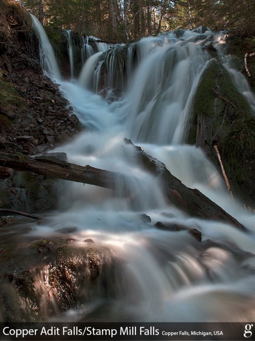
n2c_113-4482, photo by Gowtham

Gowtham writes:

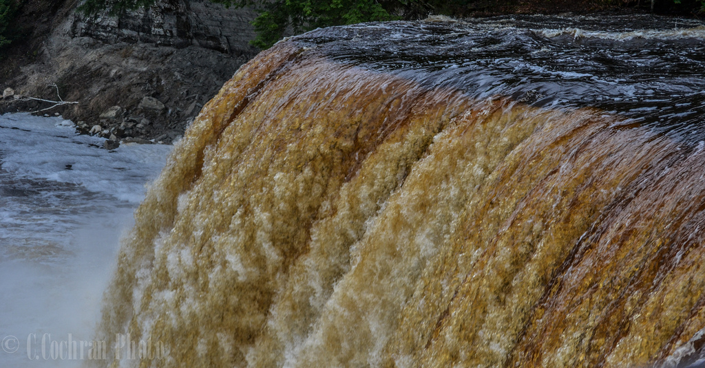
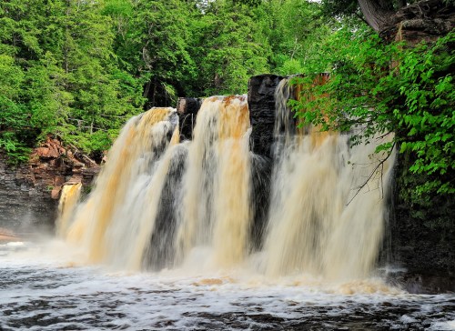
Established in 1846, Copper Falls mine was a collection of several copper mine shafts and adits (definition below). Owl Creek — in what was once one of the richest fissure veins in the Keweenaw — seems to make a magical (and a seasonal) appearance out of a hillside draining the now closed Copper Falls mine to form this quite spectacular and scenic-looking Copper Adit Falls. With the nearby remnants of an old stamp mill, this waterfall is also known as Stamp Mill Falls.

Citing Wikipedia, an adit is an entrance to an underground mine which is horizontal or nearly horizontal, by which the mine can be entered, drained of water, ventilated, and minerals extracted at the lowest convenient level.

The Copper Country Explorer’s entry on Copper Falls begins:

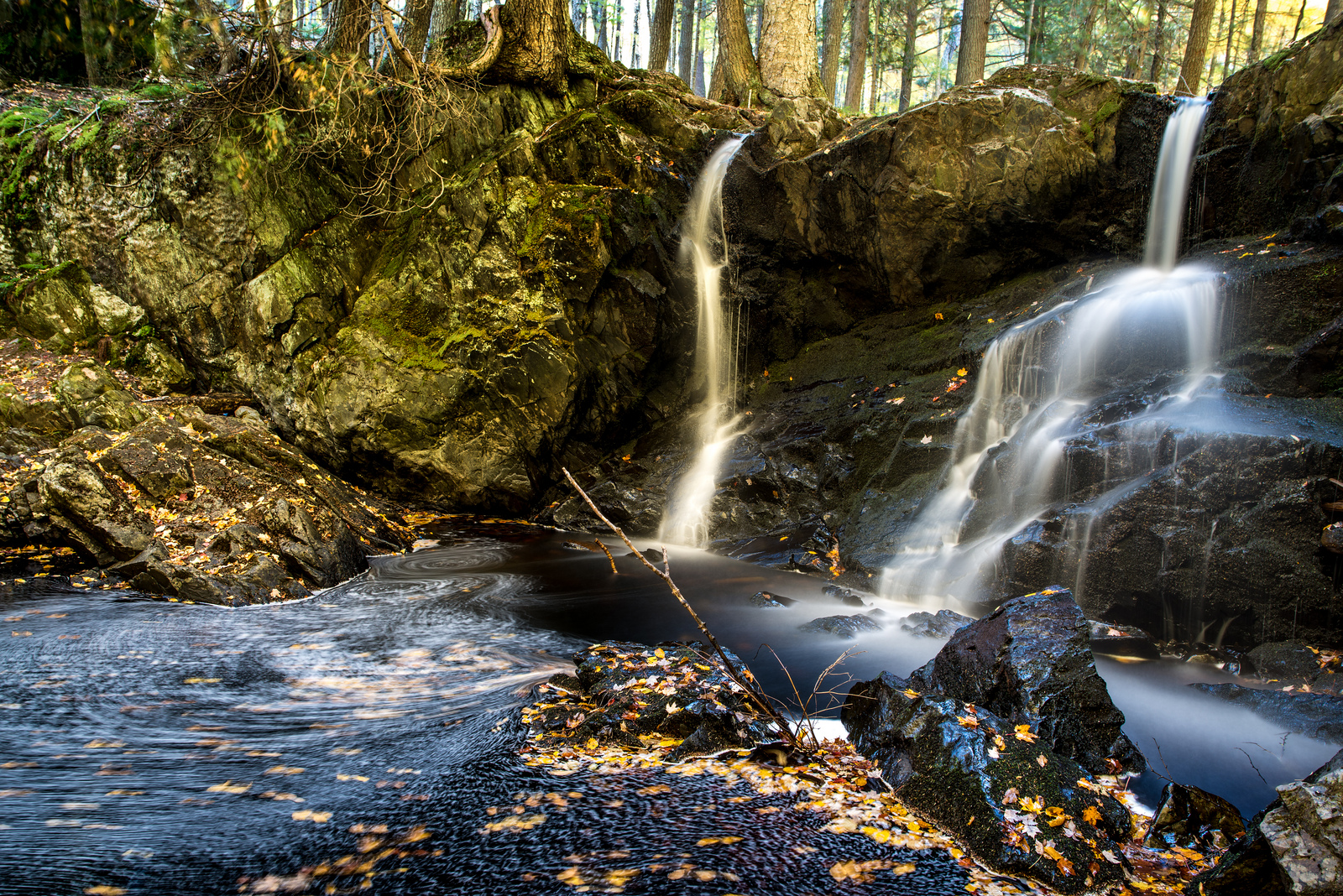
Stamp Mills relied on two things in order to separate copper: water and gravity. Any stamp mill would be built near a source of water such as a river or lake. It also would be build along a hill, in order to make the greatest use of gravity. Because of this we started our search along the creek that had cut a path through the sands – Owl Creek.

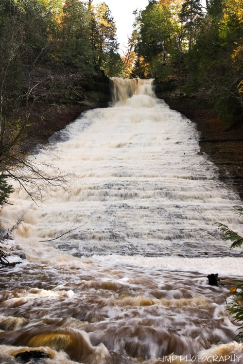
Owl Creek was the lifeblood of the Copper Falls Mine. Steam stamps required water, and along the rugged ridges of the Copper Falls a natural source existed. Fed from atop the ridge by a lake of the same name, Owl Creek drops over 500 feet to the marshlands along Superior’s shore. This creek not only provided water to the mine and mill, but the potential energy stored in its banks could easily turn a water wheel for power (mechanical power, since electricity had yet to be invented). It was a perfect spot for a mill.

Read on for lots more and explore the Copper Falls Mill at with the Copper Country Explorer.

View Gowtham’s photo bigger and see more of his photos from the area on his website.

More waterfalls on Michigan in Pictures!

Milky Way at Tahquamenon Falls

Milky Way at Tahquamenon Falls, photo by John McCormick

I try not to blog photos from the same photographer close together, but sometimes the photos have different ideas. John aka Michigan Nut took this shot on April 26th at Michigan’s largest waterfall and writes:

Upper Michigan still has over a foot of snow on the ground and the Tahquamenon river is RAGING from the runoff. The mist was freezing on my camera. I think the light on the left side of the image is coming from the little town of Paradise, Michigan.

The official Tahquamenon Falls Facebook has a great video of the spring flow which can approach 50,000 gallons per second!

View his photo of the Tahquamenon Falls bigger and see more in his jaw-dropping Michigan waterfalls slideshow.

More Tahquamenon Falls and more waterfalls on Michigan in Pictures.

Support Michigan in Pictures with Patreon