Return to the Eben Ice Caves

icecave

icecave, photo by johndecember.

A lot of folks have been coming by this month looking for pictures of the Eben Ice Caves in the UP’s Alger County (also known as the Rock River Canyon Ice Caves). Check out John’s Eben Ice Caves slideshow for a whole bunch of cool photos!

You can learn a lot more about this cool wintertime phenomenon at The Eben Ice Caves on Michigan in Pictures.

Castle Rock: Another (Michigan) Roadside Attraction

Castel Rock Curios

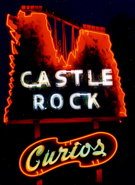
Castle Rock Curios, photos by Alan C of Marion,IN

This photo is just one of very many in Alan ‘s Roadside Finds set (slideshow) and you’ll also want to wander through his Michigan pics!

Michigan’s Roadside Tourist Attractions will be showcased in a special exhibit opening at the Michigan Historical Museum in Lansing on January 10, 2009.

Michigan’s Roadside Attractions, set to run through Sept. 14, 2009, features more than 50 roadside attractions that grew up as Michigan expanded its highway system from the 1930s through the 1970s. Many of these attractions still provide fun and excitement for millions of tourists each year.

“Deer parks and dinosaur gardens are just a couple travel experiences that take center stage again in this exhibit. Places like Castle Rock in St. Ignace, the Soo Locks Boat Tours and the multiple locations where Paul Bunyan has been spotted are also featured through photos, artifacts and souvenirs,” said Phillip C. Kwiatkowski, director of the Michigan Historical Museum System. ” Michigan’s Roadside Attractions is about treasured mementoes, from miniature Paul Bunyan statues and plastic purses to dinosaurs, seashells and even ceramic doll dish sets.”

Learn more about the exhibit from the Michigan Historical Museum.

I know you’re all wondering about Castle Rock – here’s what Roadside America has to say:

Castle Rock is an abrupt, geologic protuberance just north of the Mackinac Bridge on Michigan’s Upper Peninsula. The nearly 200-ft. column of rock was long ago augmented with a man-made ramp and walkway to provide tourists a climb for an unparalleled view of Lake Huron and distant Mackinac Island.

At the base of the Castle Rock lookout is an amusing Paul Bunyan statue accompanied by his mythical sidekick, Babe the Blue Ox. This Bunyan is rare. Instead of standing, ready to deforest Michigan, Paul sits, staring googly-eyed towards the lake. With a newspaper in his hands, we’d complete the visual that Paul is halfway through one of his mighty bowel movements.

OK, probably should have cut that one sentence earlier. Read more about Castle Rock from Hunt’s UP Guide (I learned that it only costs 50¢ to climb – definitely stopping next time!)

Sturgeon Falls on the West Branch of the Sturgeon River

Falls on the West Branch of the Sturgeon River

Falls on the West Branch of the Sturgeon River, photo by Treefarmer.

This photo is part of Treefarmer’s Waterfall set (slideshow). Not all are from Michigan, so if you’re feeling exclusive, you can see it in his Upper Peninsula of Michigan set.

Go Waterfalling’s page on Sturgeon Falls says:

Sturgeon Falls is located in the Sturgeon River Gorge Wilderness in Ottawa National Forest. The Sturgeon River has carved out a deep, forested gorge, that is 300 feet deep in some places. The falls are located deep in the gorge. The drop is only 30 feet, but the river is very powerful. Above the falls the river is well over 100 feet wide. It then narrows into a chute only about 30 feet wide before shooting over the falls, spraying mist in all directions.

The Go Waterfalling page has detailed directions and some cool movies. They add that that Canyon Falls (also on the Sturgeon River) are much easier to reach.

Should you want to reach them though, here’s Sturgeon Falls on the Absolute Michigan Map of Michigan.

Abandoned Mill, Ripley, Michigan 1997

Abandoned Mill, Ripley, Michigan 1997

Abandoned Mill, Ripley, Michigan 1997, photo by Bill Schwab.

A number of years ago, I built a site for an excellent local photographer, Greg Seman. I remember him praising the work of Detroit photographer Bill Schwab.

It was a pretty cool feeling when I saw some lovely black & white photos roll into the Absolute Michigan pool on Flickr and realized that they were Bill’s.

This photo is part of Bill’s Michigan set (slideshow), but don’t stop there

Rain on My Sunset at Isle Royale

Rain on My Sunset

Rain on My Sunset, photo by yooper1949.

Take a trip to Isle Royale National Park with yooper1949 (slideshow) and be sure to check this beauty out bigger.

Isle Royale National Park is one of our state’s true treasures. You can see more photos from this beautiful Michigan island in the Isle Royale National park group. Two cool ways to explore the pics is through this group slideshow and the Isle Royale group Flickriver.

Hope you all have a happy weekend wherever you may be.

Tumbledown on the Keweenaw Waterway

n2c_101-0545

n2c_101-0545, photo by sgowtham.

Gowtham writes that thanks to not so good winter, scorching summer and lack of rains, water level in Portage Canal (near the dredge) was observably low (without that, he probably wouldn’t have gotten this picture).

Wikipedia says that The Keweenaw Waterway:

… is a partly natural, partly manmade waterway which cuts across the Keweenaw Peninsula of Michigan. Parts of the waterway are variously known as the Keweenaw Waterway, Portage Canal, Portage Lake Canal, Portage River, Lily Pond, and Portage Lake. The waterway connects to Lake Superior at its north and south entries with sections known as Portage Lake and Torch Lake in between. The primary tributary to Portage Lake is the Sturgeon River.

Originally a small river used by natives for transportation and fishing, the waterway was dredged and extended in the 1860s in a joint venture between the United States Government and several mining corporations. The expanded canal allowed freighters to haul copper from the rich copper mines of the Keweenaw Peninsula out through Lake Superior to larger cities. It also enabled supply boats and freighters to reach the cities of Houghton and Hancock, which supplied goods to most of Michigan’s copper region. The local mines’ stamp mills dumped large quantities of stamp sand (containing traces of copper and chemical leaching agents) into the waterway, causing significant environmental damage near the sand dumps.

It’s part of the Keweenaw Water Trail.

He has many more great photos at sgowtham.net and you can also check out his Flickriver.

Fall color from the top of Michigan

Fall color from summit peak

Fall color from summit peak, photo by mtsn.

Well, Summit Peak in the Porcupine Mountains Wilderness State Park isn’t the highest point in Michigan. However, as the very detailed article on the Porcupine Mountains at climbing, mountaineering, hiking site SummitPost explains:

The Porcupine Mountains rise from the shore of Lake Superior in the far western Upper Peninsula of Michigan. They are not remarkably high by some standards but for this part of the midwest they represent some of the most rugged terrain around. The “Porkies,” as they are known by locals, are actually a series of three ridges that lie parallel to the shoreline. The mountains are preserved within the borders of Porcupine Mountains Wilderness State Park.

The first ridge rises 1000 feet directly from Lake Superior to a maximum elevation of around 1600 feet. The lake-side of the escarpment rises steeply but gradually while the south side is a 300-500 foot cliff overlooking the Big Carp River valley and the famous Lake of the Clouds.

The second ridge is a bit higher, reaching an elevation of 1850 feet at Government Peak. Again, the north slope of this ridge is gradual but steep. The south side however does not drop off like its neighboring ridge to the north. the two Mirror Lake sit in this high valley at about 1500 feet in elevation.

The third, and southernmost, ridge is the highest. The height of land is known as Summit Peak and it is the 3rd highest point in Michigan at 1958 feet. Climb the 50 foot observation tower at the summit, however, and you will be standing higher than even Michigan highpoint Mt. Arvon. Summit Peak does command an impressive view but does not rise from its surroundings as drastically as the ridges to the north because the terrain here averages around 1500 feet in elevation.

Read on for lots more information about hiking in the Porkies, links and photos. For some reason their map didn’t work for me, so here’s Summit Peak on the Absolute Michigan Map!

Speaking of photos, the one above was taken on Tuesday (Oct 7) and is wallpapery fresh for all your computer background needs. Kiyo has plenty more in her Porcupine Mountains State Park set (slideshow). She also operates a Japanese language site with Michigan tourism information.

More fall wallpaper on Michigan in Pictures

Autumn in Alberta, Michigan

DSC_6567

DSC_6567, photo by jsorbieus.

Jim took this photo in Alberta, Michigan, an unincorporated community in L’Anse Township of Baraga County:

The community was originally founded in 1936 after Henry Ford declared the banks of the Plumbago Creek to be an ideal spot for a sawmill. Ford named the town “Alberta” after the daughter of one of his top executives, Edward G. Kingsford.

At the time Ford established Alberta, wood was used extensively in automobiles. Mr. Ford envisioned the town as a model sawmill community; consisting of twelve houses, two schools, and a steam driven mill built to the most modern standards of the day. The Plumbago Creek was dammed to provide a reservoir to serve the town and mill’s water supply needs. The mill was a two-story white clapboard wood frame structure and still stands, now housing a portion of the Alberta Village Museum. The saw mill had a capacity of 14,000 board feet per day for hardwood and 20,000 board feet per day for softwood. This was a small capacity even by 1936 standards, with Mr. Ford’s other three mills in the Upper Peninsula of Michigan producing twenty to twenty-five times as much.

In 1954, Ford Motor Company donated the town of Alberta, Michigan and 1700 acres of land to what is now the School of Forest Resources and Environmental Science at Michigan Technological University.

Alberta buildings still standing on the property are used as a museum, support research and teaching programs for forestry and ecology majors, and are used by numerous universities from around the United States for forestry education.

Read more about The Ford Center from MTU.

Jim has a whole lot more big, background sized photos of fall’s glory in his U.P. set (slideshow). You can see more photos from the area on the Flickr map for Alberta.

More autumn wallpapery fresh in the Michigan in Picturesfall wallpaper collection!

Michigan’s Common Snapping Turtle

Female Snapping Turtle

Female Snapping Turtle, photo by MTU_Flickr.

Regular readers may recall TurtleGate ’08. Some of you may have even been consumed by worry that this terrapin tangle would go unresolved. Fear not, for thanks to a happy find while researching the Seney National Wildlife Refuge, I can finally put the michpics universe back on firm & factual footing.

MTU Flickr says that this little lady was looking for a good place to lay some eggs in the Seney Wildlife Refuge during sunset. It’s part of their excellent Nature Made set, a collection of photos “mostly set in the Upper Peninsula” that should probably be viewed as a slideshow.

The common snapping turtle (Chelydra serpentina) and probably (other than the elusive cougar), the Michigan animal you most want to be wary of. From the U of M Animal Diversity Web’s page on the common snapping turtle:

Snapping turtles are not social creatures. Social interactions are limited to aggressive interactions between individuals, usually males. Many individuals can be found within a small range; snapping turtle density is normally related to the amount of available food. Snapping turtles can be very vicious when removed from the water, but they become docile when placed back into the water. Snapping turtles sometimes bury themselves in mud with only their nostrils and eyes exposed. This burying behavior is used as a means of ambushing prey.

Snapping turtles will eat nearly anything that they can get their jaws around. They feed on carrion, invertebrates, fish, birds, small mammals, amphibians, and a surprisingly large amount of aquatic vegetation. Snapping turtles kill other turtles by decapitation. This behavior might be territoriality towards other turtles or a very inefficient feeding behavior.

You can read much more about these agressive amphibians from the link above and also the Michigan DNR and Wikipedia. Also check out this video of a common snapper attacking a camera to get an idea of how fast they can move if they want to!

You may want to go back and read the other post too as it now has information about the wood turtle in Michigan.

Menominee North Pier Light

Menominee Michigan Lighthouse

Menominee Michigan Lighthouse, photo by Lara Salonen.

You can see more photos of this cool pier light (and see them bigger) in Lara’s Menominee slideshow.

Terry Pepper’s page on the Menominee North Pier Light (at the mouth of the Menominee River on Green Bay) says that after harbor improvements were completed in 1927:

… a prefabricated octagonal cast iron tower was delivered by vessel, and lowered onto the pier.

Click to view enlarged imageThe thirty-four foot tower was painted white, and integrated with an attached fog signal building. An elevated wooden catwalk stretched along the wooden pier to provide the keepers with safe access to the light during periods when waves crashed across the surface of the pier. The octagonal cast iron lantern room was outfitted with a Fourth Order Fresnel lens of unknown manufacture.

At some point thereafter, the wooden pier was replaced by a concrete structure with a forty-foot diameter circular crib at its offshore end. At this time, the fog signal was eliminated with the inclusion of an automated electrically operated signal in the tower. With automation of the light in 1972, the need for daily maintenance of the light was also eliminated, and the iron catwalk was removed from the pier.

Dave Wobster’s page on the Menominee Light has some great photos and says that the 10-sided lantern no longer contains the original Fourth-Order lens, which has been moved to the restored Sand Point Lighthouse in Escanaba.