Confluence of Montreal River and Lake Superior

confluence-of-montreal-river-and-lake-superior

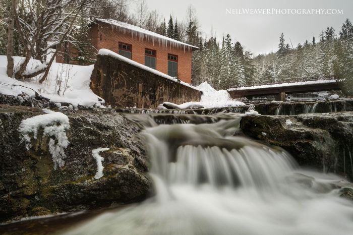
Confluence of Montreal River and Lake Superior, photo by Kirt E. Carter

Waterfalls of the Keweenaw has a nice feature on the Montreal River and Montreal Falls that says in part:

Located right at the mouth of the Montreal River as it tumbles into Lake Superior, Montreal Falls is a rugged, beautiful cascade over blocky volcanic rocks. The views over the lake are incredible: to the west you can see Bare Bluff and Mt Bohemia rising along the lake shore, to the southwest the distant side of Bete Gris Bay, and to the south (on a clear day) the Huron Mountains ripple up above the lake. The drop sits at the last easily accessible southern spot on the tip of the Keweenaw, with Fish Cove, Keystone Bay, and Keweenaw Point a tough drive/hike beyond.

Some flat ground for camping sits on the shore of the waterfall, complete with a few fire rings and a convenient beach for kayakers, and during summer weekends a few tents can be found near the falls. A narrow trail leads up along the river towards Upper Montreal Falls, more traveled by fishermen than anyone else, and an even fainter path can be found leading further east to Fish Cove.

Read on more maps & more!

View Kirt’s photo bigger, see more in his slideshow, and see more work on his website.

Below Au Train Falls

below-au-trail-falls

Below Au Train Falls, photo by Neil Weaver Photography

The Au Train Falls information page from Chatham, MI says (in part):

The AuTrain Falls are part of the AuTrain River. A major reason why the falls were created is because of the large power dam located about a mile south of the falls site, in close proximity to highway M-94. The Forest Lake Dam, run by the Upper Peninsula Power Company, is the main source of water for the falls. When water levels are high on the AuTrain Basin, an increased flow of water is released via the dam and down the river. The AuTrain River actually flows from South to North. When more water is released via the dam, the more volume of water that flows through the falls.

…A short distance from the bridge, where the view is the most spectacular, is where an old brick building is located. As you approach the building, you will hear a humming noise and as you approach, the humming noise gets louder and louder. As you peak inside the building, you will notice these large lime-green mechanical devices. These are power generators. These generators create enough power to supply 600 homes in the area. The water to supply the generators also comes AuTrain Basin, but travels through large metal piping running from the Forest Lake Dam to the generator site. Once the water runs through the generator, it is released in the back of the building and back into the river. It is a unique facility, and one that is still an important part of the area.

Read on for more.

View Neil’s photo bigger, follow him on Facebook, and be sure to check out the Michigan Waterfalls gallery on his website!

Saxon Falls on the Montreal River

saxon-falls-on-the-montreal-river-by-marty-hogan

Saxon Falls on the Montreal River, photo by Marty Hogan

GoWaterfalling’s page on Saxon Falls says (in part):

Saxon Falls is located on the Montreal River just a few miles upstream of Superior Falls, about 10 miles west of Ironwood. The Montreal River forms part of the border between Michigan and Wisconsin so the falls is technically in both states. It can be visited from either side, but both require a bit of work.

Like Superior Falls there is a dam and power plant here and the water is diverted. Unlike Superior Falls there is no visitor friendly viewing area for the falls. The falls are large and complicated. I visited the Wisconsin side where trees obscure most views of the falls. There are more drops than the one pictured. This is the upper drop. The lower drop is best seen from the Michigan side.

Read on for visiting tips!

View Marty’s photo background bigilicious and see more in his 2016 October Photo Trip slideshow. Seriously, do it – some awesome photos there!

Good morning from Bond Falls

good-morning-from-bond-falls

Good morning from Bond Falls….Burrrrr, photo by Joe Garza

View Joe’s photo bigger and see more at JMG Photography on Facebook.

More Bond Falls on Michigan in Pictures.

Support Michigan in Pictures with Patreon

Lower Silver Falls

lower-silver-falls

Lower Silver Falls, photo by Tom Mortenson

GoWaterfalling’s page on Lower Silver Falls says:

Lower Silver Falls is located in Michigan’s Baraga county on the Silver River. The Silver River has many drops, and they are lumped together into the Lower, Middle and Upper Falls. The Lower Falls are not particularly impressive but they are very easy to visit.

The falls consists of two chutes where the river is constricted to a narrow channel. The second is the larger of the two, and the river drops about 15 feet in a thirty foot stretch while taking a turn.

Head over to GoWaterfalling to read about their big brother upstream, the Upper Silver River Falls!

View Tom’s photo from early October background big and see more in his Upper Michigan slideshow.

A degree above freezing

a-degree-above-freezing-on-the-little-muskegon-river

A degree above freezing on the Little Muskegon River, photo by Jay

View Jay’s photo background bigilicious and see more in his slideshow.

More fog & mist on Michigan in Pictures.

Yesterday on the Platte River

fall-color-on-the-platte-river

Platte River, photo by Aaron Springer

Today’s photo shows that fall color is still hanging on … as does the latest cover for the Michigan in Pictures Facebook that I took not far away yesterday. Definitely still color out there to be had!!

View Aaron’s photo of this gorgeous maple at a bend on the river bigger and see more in his slideshow.

Misty Bond Falls

misty-bond-falls-by-yanbing-shi

Misty Bond Falls, photo by Yanbing Shi

Gorgeous photo from Bond Falls in the western Upper Peninsula taken back in October of 2014. GoWaterfalling’s page on Bond Falls says (in part):

This is the best single waterfall in the Western U.P, and the second best waterfall in Michigan. If you are in the Western U.P., possibly on your way to or from the Porcupines or Copper Harbor, this is a definitely worth a stop.

…The main drop is 40 feet high and 100+ feet wide. Above the main falls are a series of cascades and rapids that must drop a total of 20 feet. The water level is controlled by a dam, and a steady flow over the falls is maintained for scenic reasons. Of course during the spring melt the flow is much higher.

View Yanbing Shi’s photo bigger and see more from Michigan and elsewhere in his Landscape slideshow.

More Michigan waterfalls and more fog & mist on Michigan in Pictures.

Friday Fall Color Update from the High Rollways


high-roll-away-buckley-michigan

High Roll Away, photo by Charles Bonham

“Of all the places I’ve worked here in Michigan, this is my favorite place to collect my senses, do a little meditating and get rid of my problems. It’s like a soothing balm.”
-Ray Westbrook, retired DNR on the High Roll-Away

Charles took this yesterday at the Buckley High Roll-Away overlooking the Manistee River, and it shows how autumn color continues to lag a bit behind in northern lower Michigan. mLive posted some satellite pics of fall color from NASA’s Aqua satellite earlier this week that give you a look at how things are shaping up. If you’re thinking about a jaunt, Pure Michigan’s fall color tours provide some pre-planned ideas all over the state. To get current fall color, I usually find it best to pick your location and call their chamber or visitor’s bureau. The bigger ones in Traverse City, Petoskey, Marquette, Grand Rapids, and elsewhere will often have a good idea about a large range.

MyNorth’s Jeff Smith has a great story on Buckley’s Big View that says in part:

Like any notable landmark without an official name, this one goes by several aliases—Horseshoe Bend Overlook, Lookout Point or the Highbanks Overlook—not to mention spelling variations. Depends who you ask.

Stand atop the Roll-Away and the scenery is for certain. From the lookout it’s 200 feet down, and before you the valley curls up like a vast bowl, taking in a viewscape of almost 130 square miles of dense pine and hardwood forest. The bowl’s rim, a ridge, runs roughly from Manton in the east, around to Meauwataka and Harrietta in the south (you’ll see the distant radio towers), and on the west to Mesick.

Here, more than a century ago, the expanse of treetops inspired awe among those who saw wealth in the more than 1.2 billion board feet of lumber in the upper Manistee River basin. Surveying the area in 1869 for the Manistee River Improvement Company, A.S. Wordsworth wrote, “This river is the great highway that penetrates the vast pine region of Manistee. … It is without doubt the best logging stream in the world, and all along its circuitous path, reaching far away, it seems to bear mute testimony to the wonderful wisdom of the Creator.”

Read on for lots more and here’s the map on Waymarking!

You can get Charles’ photo background bigtacular and see more in his slideshow.

Lots more fall color and fall wallpaper on Michigan in Pictures!


Manganese Falls on the Keweenaw Peninsula

manganese-falls

Manganese Falls, photo by John Gagnon

GoWaterfalling’s page for Manganese Falls says in part:

Manganese Falls is a steep cascade falling into a narrow gorge. The gorge is so narrow that it is actually hard to see the falls. There is a well marked overlook for the falls, but trees mostly obscure the falls. The overlook is perched on top of a sheer cliff, so do not even think about climbing over the fences for a better view.

It is easy to get to the top of the falls and you can look down the gorge. Even better views of parts of the falls can be had from the far side of the gorge. A large stretch of the main drop is visible. Getting a shot of the base of the falls would be very difficult. First there is a large pool at the base of the falls surrounded by steep walls, with apparently no dry places to stand. Second getting down there would be very difficult and dangerous.

Manganese Falls is located along Manganese Road just south of Copper Harbor. The road is paved, but steep in places. The falls are less than a mile from town.

Read on for more including some visiting tips and alternative viewing ideas.

View John’s photo background bigtacular and see more in his Rivers/streams slideshow.

More waterfalls on Michigan in Pictures