Sunrise at Gabbro Falls

Sunrise at Gabbro Falls by Neil Weaver

Sunrise at Gabbro Falls by Neil Weaver

GoWaterfalling’s page on Gabbro Falls has directions to this western Upper Peninsula waterfall and begins:

Gabbro Falls is on the Black River and is as impressive, if not more impressive, than its more celebrated neighbors downstream along the Black River Scenic Byway. This is a largely wild waterfall with no fences or barriers of any kind. It consists of three separate drops. When the water is high there is a fourth drop that is the height of the other three combined. The main drop falls into a narrow crevice between two large rock formations.

Follow Neil on Facebook and for sure head over to his website to view & purchase prints. This pic is on his Michigan Waterfalls page!

Support Michigan in Pictures with Patreon

River Otters and the Detroit River comeback

River Otter by Ashleigh Mowers

River Otter by Ashleigh Mowers

Great Lakes Now has an excellent feature on the return of river otters to the Detroit River that says (in part):

On the cool morning of April 25, doctoral student Eric Ste Marie from the University of Windsor’s department of integrative biology went out for a walk with his partner along the Detroit River prior to an anticipated long day in his lab. Much to his surprise, he saw an animal pop its head out of the water. It was too big to be a mink and, as it dove, he noticed that it did not have a flat beaver tail. Ste Marie ran out to the end of a pier beneath the Ambassador Bridge to get a closer look to check, and there it was: a river otter.

River otters were quite common in southeast Michigan, including the Detroit River, up through the arrival of European explorers and fur traders,” said Gearld P. Wykes, a historian from the Monroe County Museum System. “During the fur trade era, they were much sought after for their fur, along with beaver. Based on historical records, river otters were likely extirpated from the Detroit River in the early 1900s.”

In 1986, the Ohio Department of Natural Resources reintroduced river otters into high water quality rivers and streams in eastern Ohio. The river otters thrived. As their population grew, they began to move westward – what scientists call expanding their range. By the early 2000s, they had found a home in western Ohio, particularly near Cedar Point and Ottawa National Wildlife Refuge, just east of Toledo.

…Biologists studying the Detroit River and resource managers have been excited about the possible range expansion of river otters into the Detroit River. There have been a few anecdotal reports from citizens, but no photographic or videographic proof until Ste Marie was greeted with that ecological surprise on the morning of April 25.

…River otters are considered an indicator species, and their return to the Detroit River after an absence of more than 100 years is a hopeful sign of improving watershed conditions.

Ashleigh took this back in 2016 in Detroit at the Detroit Zoo. Hopefully she gets a shot of them in the wild! See more in her Detroit gallery on Flickr & for sure check out her Go See Do Photography website for more great pics!

More about River otters on Michigan in Pictures.

Support Michigan in Pictures with Patreon

Heading upriver

The Karen Andrie and Endeavor by Craig Hensley

The Karen Andrie and Endeavor by Craig Hensley

Craig got this tasty shot of the tugboat Karen Andrie and the barge Endeavor making their way up the Detroit River last summer. Detroit is on the left & Windsor, Canada is on the right. 

Head over to Craig’s Flickr and his website for more!

Support Michigan in Pictures with Patreon

Interstate Falls on the Wisconsin – Michigan border

Interstate Falls on the Wisconsin - Michigan border by Tom Clark

Interstate Falls on the Wisconsin – Michigan border by Tom Clark

Tom shares, “Interstate Falls is an 18-foot waterfall on the Montreal River, along the Wisconsin / Michigan border, at the edge of the City of Ironwood, Michigan and Hurley, Wisconsin. A 0.3 mile trail through hardwood-hemlock forest leads to the falls, and is a popular attraction to residents and visitors of the Gogebic Range.”

See more in his North Shore Waterfall Trip 2020 & see lots more on his website

Support Michigan in Pictures with Patreon

Golden Rays over Canada

Golden Rays over Canada by Craig Hensley

Golden Rays over Canada by Craig Hensley

Craig got this supersweet drone shot of downtown Detroit last week. In his photo you can see Belle Isle, the sun shining on Canada across the Detroit River at the left, the Renaissance Center towers in the center, and the art deco Guardian Building in the foreground. 

See more great shots in Craig’s Detroit gallery & view and purchase his work on his website.

Support Michigan in Pictures with Patreon

Waterfall Wednesday: Victoria Dam Falls

Victoria Dam & Falls by Nathan Miller

Victoria Dam & Falls December 2021-11 by Nathan Miller

The Waterfalls of the Keweenaw entry for Victoria Dam Falls has directions & says in part:

This section of West Branch Ontonagon River was once the home of the famous Ontonagon Boulder (a copper boulder now housed in the Smithsonian weighing almost two tons) and a tall, impressive waterfall. A dam and basin now covers both landmarks and only an overflow channel, one that is rarely flowing, remains. Viewing the drop is easy as it flows down from the opposite bank facing an access point.

Nathan took this back in December of 2021. For sure head over to Flickr to see this & other shots extra big in his Victoria Dam & Falls gallery

Support Michigan in Pictures with Patreon

Frozen Falls Friday

Upper Tahquamenon Falls by S Hughes Photos

Upper Tahquamenon Falls by S Hughes Photos

S Hughes shared this sweet shot from a subzero sunrise the other day at the Upper Falls in Tahquamenon Falls State Park.  Follow her on Facebook & for sure check out her video from the overlook!

Support Michigan in Pictures with Patreon

Running Dry: Climate change & river fishing in Michigan

Fishing on Michigans Au Sable by J Carl Ganter

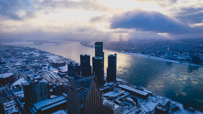
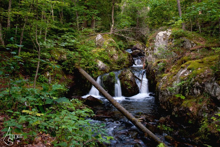
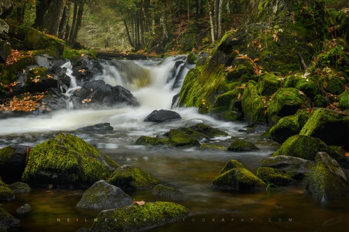
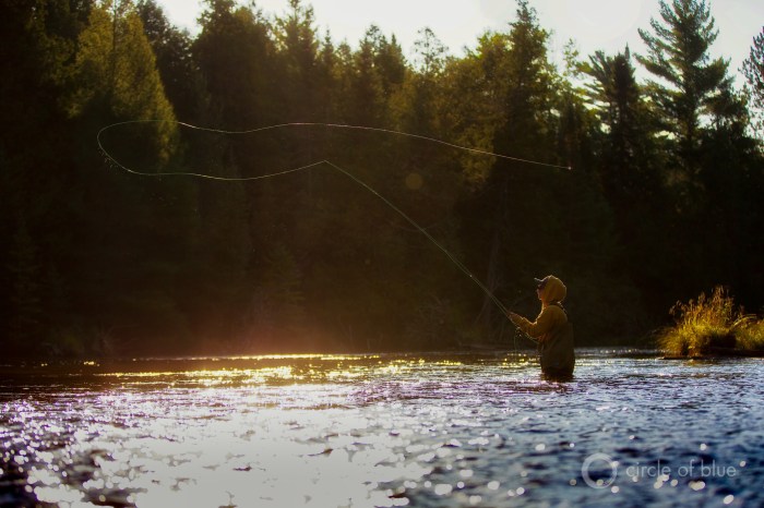
Fishing on Michigan’s Au Sable by J Carl Ganter

“I grew up hearing stories about how great fishing was just five years ago. It’s sad, knowing that I’ll most likely never be able to experience the amazing fish that these waters used to have … that these rivers will never be what they used to be.”
-Michigan angler Landen Finkel

The above quotation & photo are from an excellent Circle of Blue article on the impact of climate change on our nation’s trout streams. It’s a great read with a focus on Michigan that I hope you can check out:

In some places, the effects of climate change manifest as immediate catastrophe. Violent storms. Extreme heat. Deep drought. On the Au Sable, the threat is a slow burn. Intensifying weather patterns have gradually added stress to the ecosystem, chipping away at wildlife’s ability to adapt. As the atmosphere continues to warm, severe weather events have gone from occasionally urgent to relentless assault.

“The guides of the Au Sable, we’re on the front lines,” (Au Sable River Guide) David McCool said. “Just a small change in temperature can have a massive impact on this resource. We need to make sure we still take care of it, as things change in our environment.”

Ecologically speaking, fish are the canary in the coal mine. Trout are an indicator species in the Au Sable ecosystem, meaning that their well-being reflects the health of the ecosystem. “Healthy trout is indicative that the whole system is healthy,” said Randy Claramount, a biologist with Michigan’s Department of Natural Resources. Likewise, unhealthy populations are an alarm bell: the poor water quality conditions that cause trout to suffer are likely also stressing invertebrates and other biota.

“You start piling these things on top of one another, and it just gets harder for those fish to adapt to what nature’s throwing at them,” said Keith Curley, a conservationist with Trout Unlimited.

…The decline of river ecosystems is intensifying young anglers’ anxieties about the health of the planet. At just 14 years old, Landen Finkle worries about the condition of the river near his home in Traverse City, Michigan. He’s particularly concerned about the loss of biodiversity.

Like a majority of his generation, climate and environmental issues weigh on his mental health. Finkle is fascinated with freshwater ecology, and hopes to guide fishing expeditions one day. But increasing signs of the river’s decline make him feel helpless at times, and fearful for the future of the pastime.

“River fishing is a really calming thing. And just to know that that could be coming to an end here is kinda sad,” he said. “It creates a lot of anxiety. There are a lot of things we can do to help, but there’s not really enough resources to help.”

Read on for more including more pictures from J. Carl Ganter & even some video of Landen fishing! Be sure to check out Circle of Blue for all kinds of features on climate & resources in Michigan and worldwide.

PS: If you still think climate change is a hoax, I not only do not want to hear about it, I would prefer that you find someplace else for your daily Michigan photos. It’s not & it’s long past time for you to have woken up to reality.

Support Michigan in Pictures with Patreon

Waterfall Wednesday: Reany Creek Falls

Reany Creek Falls by Aaron Strouse

Reany Creek Falls by Aaron Strouse

Waterfalls of the Keweenaw entry for Reany Falls says in part:

With a location close to a well-known Marquette destination (Dead River Falls) Reany Falls is a surprisingly photographed and popular waterfall. Composed a few small drops along a narrow creek, the main focus is a three-way split plunge nestled in the bedrock that is viewable from the road’s bridge above. Smaller drops are located above these falls, although the narrow little canyon makes viewing them difficult.

Aaron took this photo back in August of 2017. See more in his massive Michigan waterfalls gallery on Flickr.

More Michigan waterfalls on Michigan in Pictures!

Support Michigan in Pictures with Patreon

Waterfall Wednesday: Kakabika Falls

Kakabika Falls by Neil Weaver

Kakabika Falls by Neil Weaver

Travel the Mitten has a great entry on Kakabika Falls that says (in part):

The Ottawa National Forest covers more than 990,000 acres of Michigan’s Upper Peninsula and is a popular spot for outdoor recreation, camping, and wildlife viewing. The forest is also home to many waterfalls including Kakabika Falls, a set of cascades on the Cisco Branch of the Ontonagon River. These falls can be reached by a short drive north of the Watersmeet/Marenisco area, and a short, easy hike into the woods. The setting here is peaceful and there is a good chance you won’t encounter other travelers when you visit.

The tallest drop of Kakabika Falls is maybe 8 to 10 feet (most of the drops range from 1 to 5 feet), but this waterfall is more about the sum of its multiple drops than one large drop. The river makes a series of S turns here, and the trail closely parallels the river providing many great vantage points of each drop. As is the case with most waterfalls of this size, it is always best to visit in the spring or after decent rainfall. In dry summer months, we have found that there was barely any water flow here.

Click through for more including photos, map & directions from a really excellent website for Michigan travel ideas!

Neil shared that this is one of the many magical places in the Michigan’s Upper Peninsula, something that one look at his Instagram is all you need to see the truth in that! You can also follow Neil Weaver Photography on Facebook and view & purchase prints (including this one) on his website.

Many (many) more Michigan waterfalls on Michigan in Pictures!

Support Michigan in Pictures with Patreon