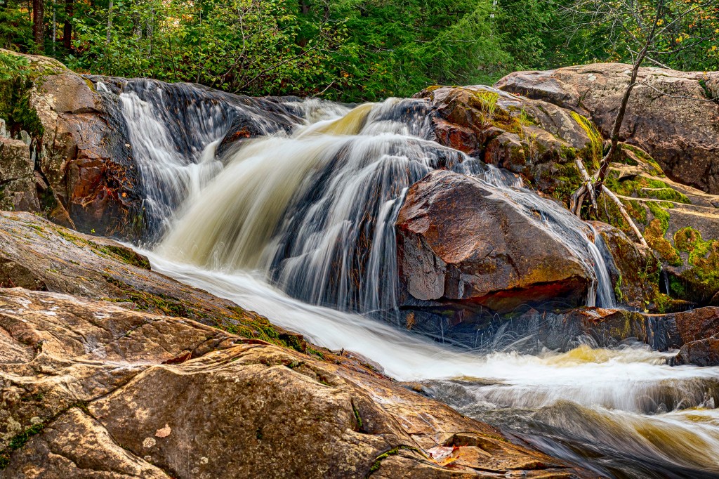
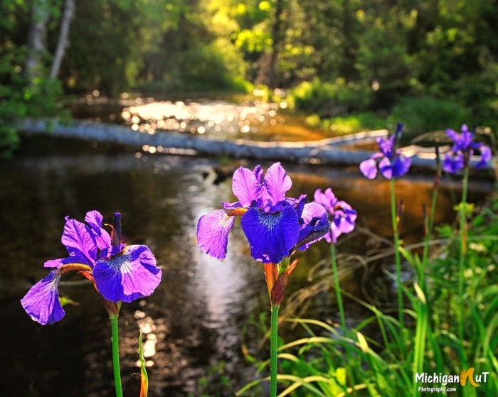
Travel Marquette shares that Yellow Dog Falls are a bit of a drive from Marquette, but well worth the drive time & not that difficult to reach with a trail along one of the wildest streams east of the Mississippi, with multiple waterfalls in just a two mile section of river.
The Yellow Dog River is one of the cleanest and least contaminated rivers in Michigan with water quality above and beyond drinking water standards that is considered a cold water fishery and a blue ribbon trout stream by the State of Michigan. Read much more from the Yellow Dog Watershed.
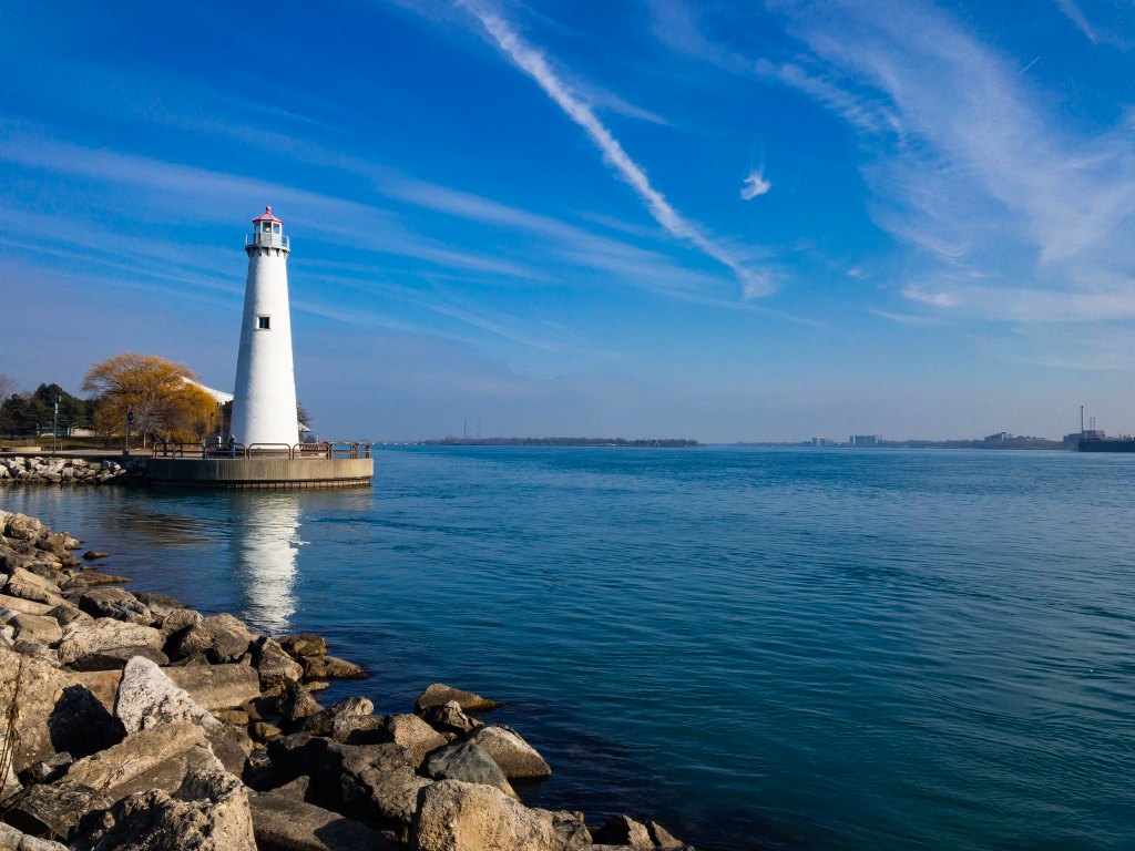
Antoine de la Mothe, Sieur de Cadillac petitioned King Louis of France to found a settlement at the south of Lake Huron in the fertile region known as le détroit to provide a secure foothold on the Great Lakes. Three hundred and twenty-three years ago, Cadillac, his men, and their Native guides traveled from Montreal and on July 24, 1701, Cadillac founded the settlement Fort Ponchartrain du Detroit in honor of King Louis’s Minister of Marine. Read more about the founding of Detroit by Antoine de la Mothe Cadillac on Michigan in Pictures.
While the buildings, sports & of course the people of Detroit are all vital components, I think nothing speaks more to the three plus centuries of the City on the Strait than the river. It brought the rich soil & trade that enabled early growth, brought raw materials & carried away finished goods in later years, and it remains central to the city’s life through a gorgeous riverfront park system that hosts incredible musical & cultural events.
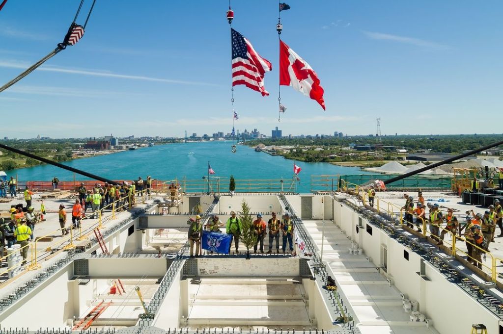
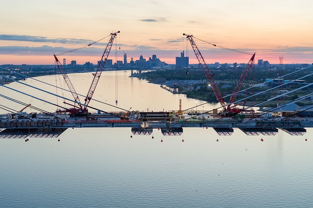
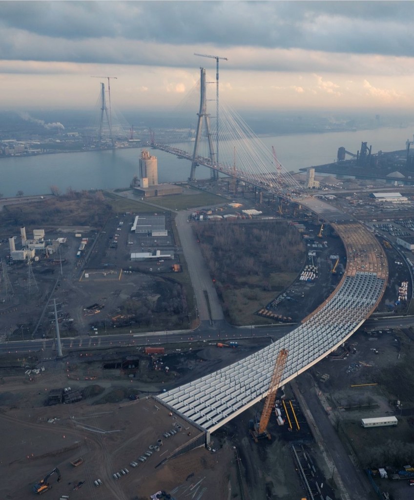
On Saturday, June 15 2024 the US & Canadian crews working on the Gordie Howe International Bridge from Windsor, Canada to Detroit joined the two sides. They share: 🌲Ironworkers on the #GordieHoweBridge project celebrate with a special ceremony dating back more than 1,000 years. Topping Out* symbolizes a connection and the evergreen tree indicates a job well done. It’s a cherished custom that Ironworkers say brings “good luck”.
Good luck to all this hardworking crew as they approach the finish line for this massive multi-year effort! Follow along on Instagram @gordiehowebrg.
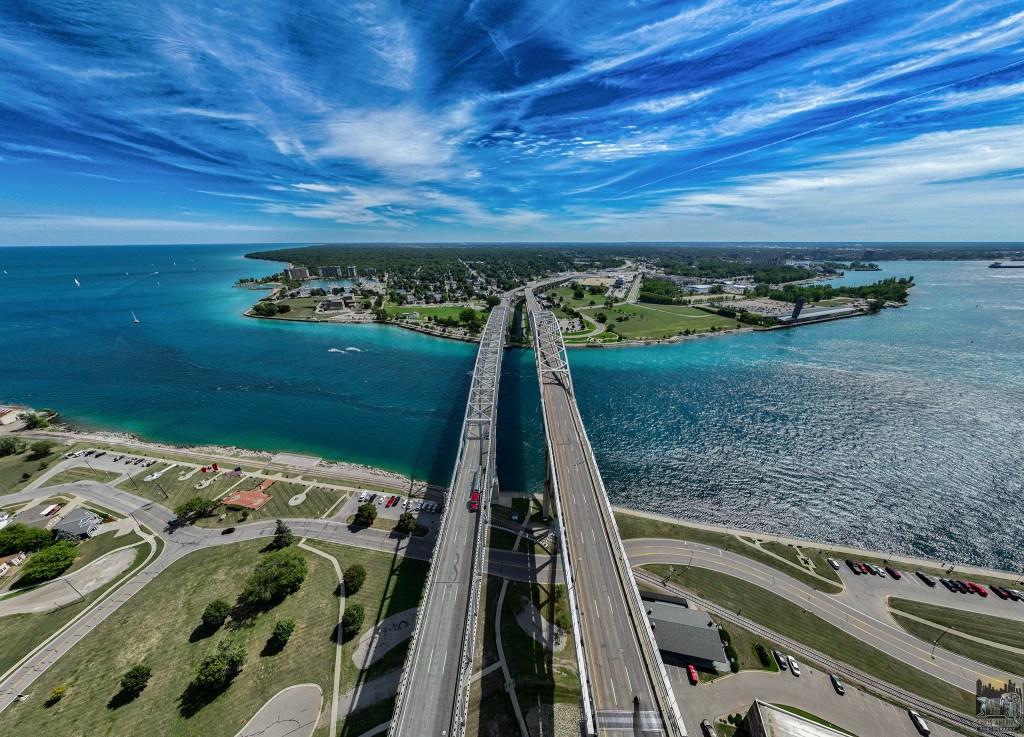
The Gordie Howe Bridge is (rightfully) getting a lot of attention these days, but another beautiful span connwcting Michigan with Canada is the Blue Water Bridge across the St. Clair River at the southern end of Lake Huron from Port Huron to Sarnia, Ontario. The Blue Water Bridge Authority shares:
The first bridge was opened to traffic on October 10, 1938. The lead engineer was Ralph Modjeski. This bridge originally had two lanes for vehicles as well as sidewalks; the latter were removed in the 1980s to make room for a third lane for automobiles. The third lane for each direction started from the apex of the bridge in order to accommodate long lineups entering each sides’ respective border crossings.
…In the early 1990s, bridge authorities decided to add a second arch in order to accommodate the high traffic. During the debate over the form of the second span, five possible designs were purposed from 1994-95. Over half of public opinion had mostly favored a duplicate of the first bridge, while the cable-stayed bridge came in second with around 21%. The Blue Water Bridge Authority had rejected both designs, due to the duplicate creating a false sense of history, while the cable-stayed option was feared to overshadow the existing bridge. Another cost-effective but unpopular design was the parallel truss. The continuous-tied arch design, which was a distant third place in polls, was chosen for two reasons. One was that it blends in with the original span yet stands out on its own, and the other is lower maintenance costs because fewer spans are involved.
Chris Ahern is a professional photographer & licensed commercial drone pilot who works in and around Detroit. Follow him on Facebook or Instagram & for sure check out his website.
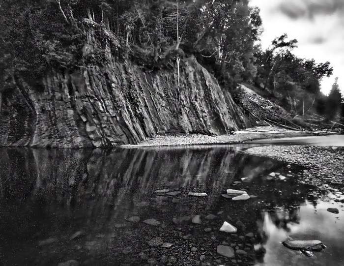
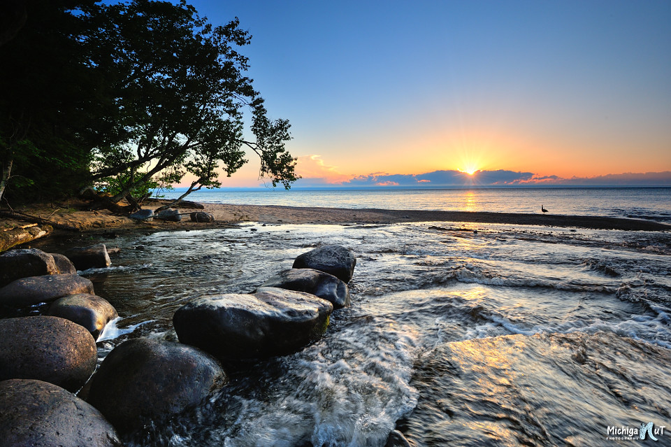
The Pictured Rocks National Lakeshore asks if you’ve ever thought about being a campground host?
If the answer is “Yes!” they are seeking a volunteer campground host for the month of June at Hurricane River Lower Campground. Volunteer campground hosts work 5 days a week and stay in a designated campsite, assisting fellow campers with information and registration, but they do not handle any money, and do not clean restrooms. Campground hosts are welcome to bring their own RVs and campers, though there are no electric or sewer hookups (vault toilets are available) and cell reception is limited.
Hurricane River Campground is on the eastern side of Pictured Rocks National Lakeshore, about 12 miles outside of Grand Marais. The campground sits above a sand and pebble beach on Lake Superior, which is dotted with shipwrecks as it stretches east towards the Au Sable Light Station.
Joey got an incredible drone shot of workers laying the last girder in place to connect the deck of the new Gordie Howe International Bridge to the Detroit Port of Entry. An astonishing project that is directed and paid for by Canada!
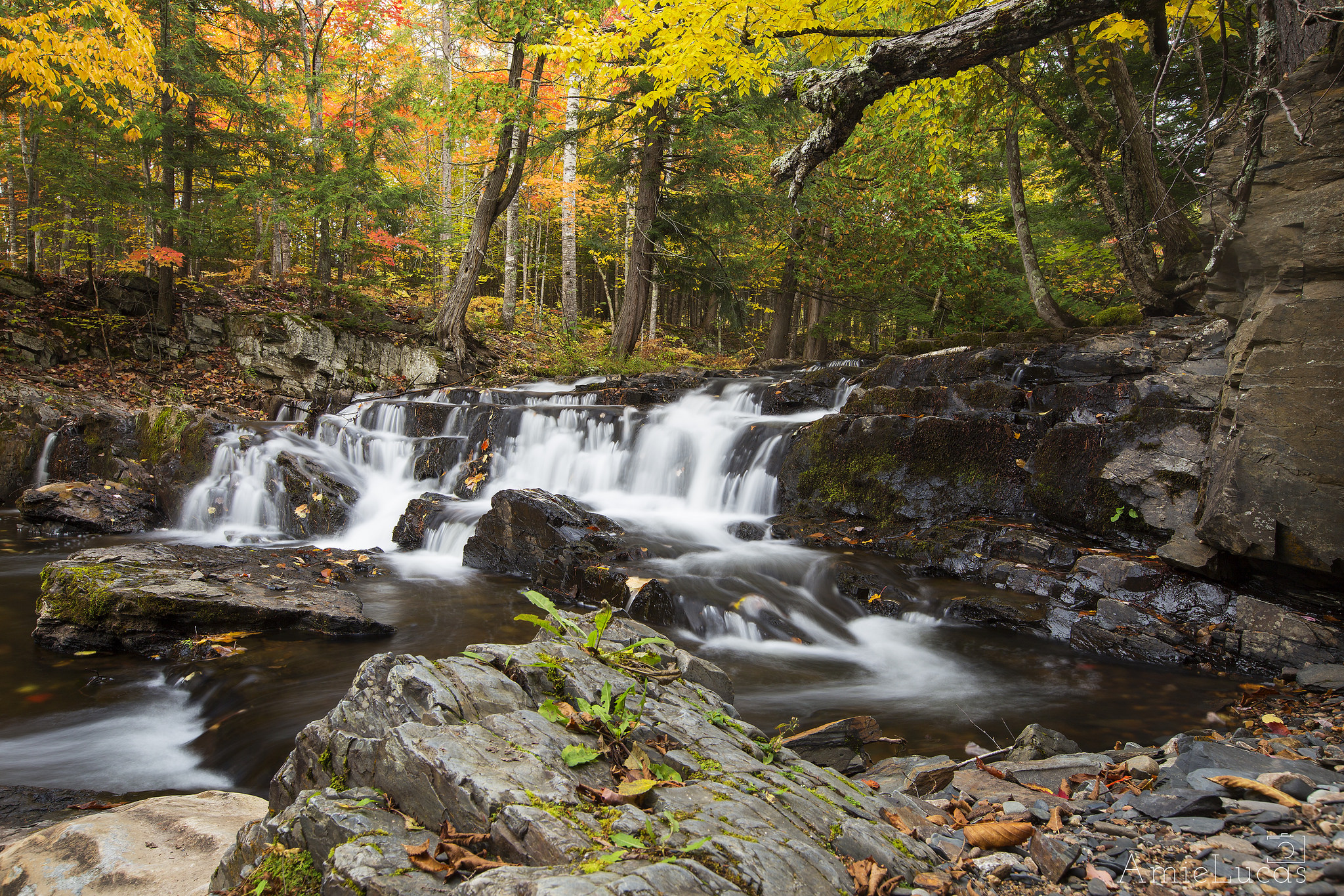
Slate River Falls is, unsurprisingly, on the Slate River. This is the largest of many drops over a three mile stretch of the river. This is a wild waterfall, with no fences, and the only trail is one left behind by the curious feet of others.
The falls are located along Skanee Road between L’Anse and Skanee, about 10 miles east of L’Anse. There is a sign marking the Slate River, so the falls are easier to find than some.
If you continue upstream past the falls a few hundred yards you can find two smaller falls, Slide Falls and Ecstasy Falls (so named by kayakers). About 3 miles upstream you can find Quartzite Falls, Black Slate Falls and more unnamed drops.
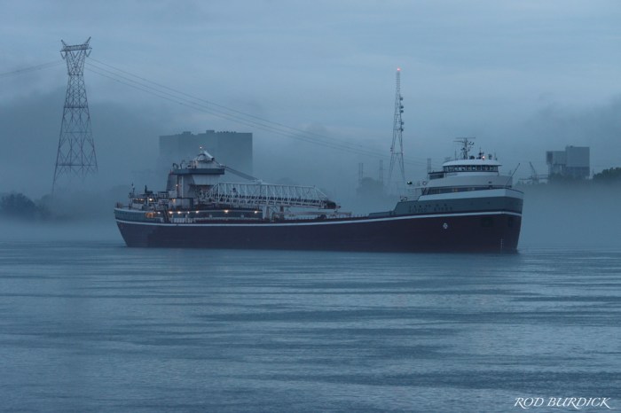
Rod took this photo of the classic laker and steamer Wilfred Sykes in fog on the St. Clair River at dawn last week. Head over to his Flickr for the latest!