Mist Woods and Porcupine Mountains terrain

Mist Woods

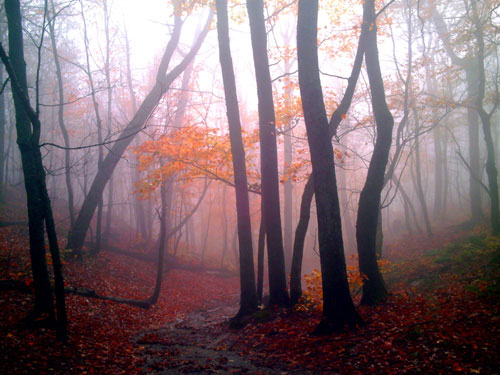
Mist Woods, photo by Kim Nixon

Kim says that this photo was taken on the way up the Summit Peak Path in the Porcupine Mountains on October 6th, 2007. She has more photos from (and writing about) the UP on her blog, The Dailies.

SuperiorTrails.com says that the view from Summit Peak is the most “don’t miss” attraction in the park. On their Porcupine Mountains Hiking Trails page, Exploring the North writes:

This trail provides an opportunity to visit Summit Peak at 1,958 feet, the highest point in the park. A 40-ft. observation tower provides an outstanding view of the park as well as the surrounding area . Wisconsin, Minnesota, the Apostle Islands, and Copper Peak are a few of the sights that can be seen on a clear day. A viewing deck on the way up to the summit provides a panorama of the Little Carp River valley and ranks as one of the best views of the park.

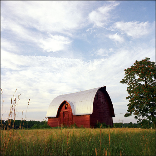
Our Absolute Michigan Map of Michigan at Google Maps got a cool upgrade earlier this week with the addition of a new “Terrain” feature, and I thought the Porkies (which probably offer Michigan’s most wild & rugged terrain) would be a perfect place to put the map through its paces – click this link to check it out and let me know what you think!

You can get a detailed trail map at the Porcupine Mountains Wilderness State Park page from the DNR.

Foggy river

Foggy river

Foggy river, photo by kthschsslr.

kthschisser writes that he took this photo of a heron on the Flint River near Flushing while rushing to the airport.

Always good to have eyes open and camera handy…

A foggy morning over Detroit

Foggy morning by MiSkyPig

Foggy morning, photo by MiSkyPig

Here’s a unique view of the city of Detroit, the Detroit River and Lake St. Clair on a misty September morning from (more or less) above Fort Wayne. Here’s a Google Map to help you orient.

Bob has several more aerial photos you might want to check out.

Avalon

Avalon

Avalon, photo by Mac Girl.

…or Millenium Park, Grand Rapids. Katie says it’s one of her favorites.

Lost Horizon

Lost Horizon

Lost Horizon, photo by 1ManWithACamera.

Lake Huron from Caseville, Michigan.

Solitude

Solitude

Solitude, photo by wizardkitten.

From a foggy day in January of 2006 January of 2005 and also from a great set of photos titled Michigan, My Michigan.

A foggy morning along the Muskegon river

The river bank

The river bank, photo by curlyson.

Do yourself a favor and view it large.

Paw Paw Barn

Paw Paw Barn by Jeff Lamb

Paw Paw, Mi., photo by Jeff Lamb

I’m guessing that you can’t buy a barn like this at Home Depot…

Jeff has a ton more photos at his Jeff Lamb Photo web site.

Pier, Donnell Lake, Mich.

Pier, Donnell Lake, Mich.

Pier, Donnell Lake, Mich., photo by shsukatsfan.

Sunrise, summer of 1983. In case you were wondering, Donnell Lake lies in central Cass County in southwest Michigan, 1 mile southeast of the town of Vandalia. The 4,659-acre watershed drains to Christiana Creek which flows south to the St. Joseph River. (DNR Fishery Report on the Donnell Lake)

You might also want to see this photo of a family at Lake Michigan from several years before 1983

Morning on Mead Creek

Morning on Mead Creek

Morning on Mead Creek, photo by alumroot.

Alan writes: Mead Creek State Forest Campground in the Upper Peninsula of Michigan Late August 1993. It was already getting cold at night which led to the lovely mist over Mead Creek. Be sure to also check out his Michigan photos – lots of cool Michigan reptiles & amphibians!

On an unrelated note (unrelated because I was not at all clever about finding a photo that would make it related), the first-ever Water Festival, a celebration of water & music happens from noon to ? in Mackinaw City. If you’re nearby, check it out!