Waterfall Wednesday: Manebezho Falls

Manabezho Falls by malderink

Manabezho Falls by malderink

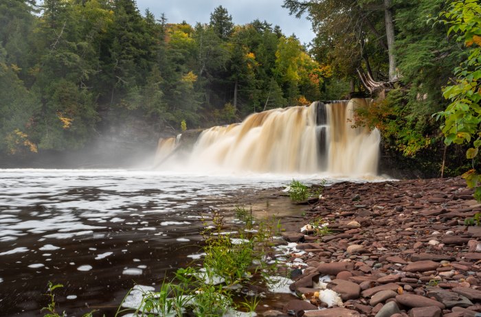
GoWaterfalling’s page on Manebezho Falls says:

The Manabezho Falls are part of the Presque Isle River’s spectacular final dash to Lake Superior. The entire 1 mile stretch is very beautiful, with lots of bare rock and rapids. It is easily accessible from the Presque Isle entrance off of CR-519 on the western end of the park…

Manido Falls are just short distance upstream. Nawadaha Falls is a bit farther upstream. Downstream of Manabezho the river plunges into a narrow gorge. The “falls” there have no name, but they are quite interesting.

The falls are located in the Porcupine Mountains State Park. More Michigan waterfalls on Michigan in Pictures!

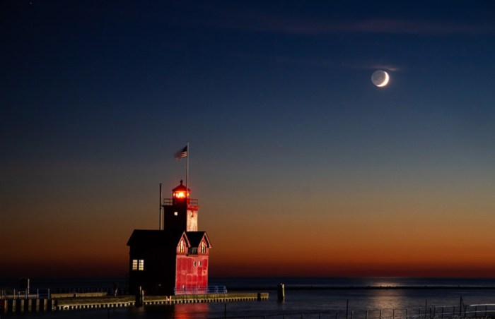
This photo is from a couple of weeks ago. Head over to malderink’s Flickr for more!

Support Michigan in Pictures with Patreon

Happy 48th Birthday, Pictured Rocks National Lakeshore!

Pictured Rocks Caves by Heather Higham

Pictured Rocks Caves by Heather Higham

Central Michigan University’s Clarke Historical Library says that on October 7, 1972 Pictured Rocks National Lakeshore was officially dedicated:

Authorized by Congress in 1966 as the nation’s first national lakeshore, Pictured Rocks National Lakeshore today encompassed over 73,000 acres of multicolored sandstone cliffs, beaches, sand dunes, waterfalls, inland lakes, wildlife and the forest of the Lake Superior shoreline. Stretching from Munising to Grand Marais, the park is a four season destination attracting everyone from hikers to campers, hunters, and casual visitors. The park is managed by the National Park Service and welcomes over four hundred thousand visitors each year.

Heather took this photo back in 2014. See more in her Pictured Rocks gallery and for sure follow her at SnapHappyMichigan on Instagram & at snaphappygal.com!

Support Michigan in Pictures with Patreon

Autumn Corn

Autumn Corn by Laurent Fady

Laurent caught a beautiful Michigan fall scene last week. See more in his Fall in Northern Michigan gallery.

Support Michigan in Pictures with Patreon

Eastside Pumpkins

Pumpkins by Glenn Susko

Pumpkins by Glenn Susko

Welcome to October!

Glen took this last month on an Eastside Camera Club outing. See more on his Flickr.

Support Michigan in Pictures with Patreon

Lake Michigamme Sunrise

Lake Michigamme Sunrise by Gary

Lake Michigamme Sunrise by Gary

Here’s sort of a Throwback Thursday … to a month and a half ago at least. Wikipedia’s entry for Lake Michigamme says that it is:

…one of Michigan’s largest lakes and reaches a depth of over 70 feet. It covers 4,292 acres in Marquette and Baraga counties, Michigan. Van Riper State Park provides public access. The vast majority of the lake lies in Marquette County, with only its westernmost part extending into Baraga County.

The lake runs about six miles east to west, with a southern arm extending about another four miles. A dam separates the Michigamme River from the main body of the lake at the end of the southern arm. The Spurr River flows into the lake’s west end and the Peshekee River flows into the lake in the northeast. Van Riper State Park and Van Riper beach are located at the eastern shoreline of the main arm. The lake is speckled with many islands and rock beds that often creep over the waterline in late summer and fall.

Gary took this toward the end of August. See more in his 2020 gallery on Flickr.

Support Michigan in Pictures with Patreon

Reflections on Fall Color

Reflected colors by Ann Fisher

Reflected colors by Ann Fisher

“How beautifully leaves grow old. How full of light and color are their last days.”
– John Burroughs

Ann took this photo back in October of 2015 on the Dead River, just west of Marquette in the Upper Peninsula. See more in her 2015 U.P. Gallery.

Support Michigan in Pictures with Patreon

Big Red & Lunar Earthshine

Evening Lunar Earthshine by Kevin

Evening Lunar Earthshine by Kevin

Our friends at EarthSky explain that lunar earthshine happens:

When you look at a crescent moon shortly after sunset or before sunrise, you can sometimes see not only the bright crescent of the moon, but also the rest of the moon as a dark disk. That pale glow on the unlit part of a crescent moon is light reflected from Earth. It’s called earthshine.

To understand earthshine, remember that the moon is globe, just as Earth is, and that the globe of the moon is always half-illuminated by sunlight. When we see a crescent moon in the west after sunset, or in the east before dawn, we’re seeing just a sliver of the moon’s lighted half.

Now think about seeing a full moon from Earth’s surface. Bright moonlight can illuminate an earthly landscape on nights when the moon is full.

Likewise, whenever we see a crescent moon, a nearly full Earth appears in the moon’s night sky. The full Earth illuminates the lunar landscape. And that is earthshine. It’s light from the nearly full Earth shining on the moon.

Read more at EarthSky.

Kevin captured the crescent moon hanging in the western sky over the “Big Red” Lighthouse at Holland State Park. See more in his gallery The Moon on Flickr.

More of and about the moon on Michigan in Pictures!

Support Michigan in Pictures with Patreon

Night Sky & Aurora from Empire Beach

Night Sky from Empire Beach by Imagination Works

Night Sky from Empire Beach by Nicholas McCreedy

The NASA/NOAA Space Weather Prediction Center has issued a G2 (Moderate) Storm Watch for September 28-29th. This means that folks in Michigan, particularly in the northern half, have a solid chance to see the northern lights!

Nicholas shared some tasty photos of the Northern Lights from Empire Beach in the Sleeping Bear Dunes National Lakeshore. Click to see them in the Northern Lights/Skies of Leelanau County NW Michigan group on Facebook & you can follow him at Imagination Works on Facebook as well!

Dig into our posts about the Aurora Borealis (northern lights) on Michigan in Pictures for all kinds of tips & science behind this beautiful phenomen!

Support Michigan in Pictures with Patreon

Michigan’s Fall Color is Just Down the Road!

US-41 by Wu Lan

US-41 by Wu Lan

mLive shared an update on Michigan’s fall color progression that says in part:

The frost and freezing temperatures for two or three days in a row last week have sparked the fall colors. A leaf’s nutrition supply is cut off from the main tree with a freeze. The underlying color pigments in the leaf then emerge for our fall splendor.

The western half of the Upper Peninsula has about 50 percent of total fall color. The eastern U.P. is around 25 percent changed now. The northern third of Lower Michigan has 25 percent to 50 percent fall color. The southern half of Lower Michigan runs from 10 percent to just spotty color from north to south.

You can also check out Pure Michigan’s Interactive Fall Foliage Map & definitely check out past fall color on Michigan in Pictures from more cool photos including the science behind fall color!

Wu took this photo back in 2015 on US-41 US-41 near Copper Harbor on the UP’s Keweenaw Peninsula. See more on their Flickr!

Support Michigan in Pictures with Patreon

The Wreck of The Nordmeer

Wreck of the Nordmeer by Chris Roxburgh

Wreck of the Nordmeer by Chris Roxburgh

The Thunder Bay National Marine Sanctuary page on the 471′ cargo freighter Nordmeer that wrecked in 1966 in Thunder Bay says:

The career of the motorship Nordmeer ended abruptly when it miscalculated a turn and ran aground 7 miles northeast of Thunder Bay Island. Some crewmen stayed on board, but they evacuated a few days later when a storm struck and tore open the ship’s bottom. Part of the vessel stands out of the water, but years of storms and ice have broken and twisted the hull. The big diesel engine stands amid the wreckage, but the cargo has been removed. A steel barge rests alongside the wreck, a relic of extensive salvage work. Some artifacts may be seen today at NOAA’s Great Lakes Maritime Heritage Center.

Chris dove the wreck a week ago and writes: “Bea and I had a big day of diving in Lake Huron today. We visited three shipwrecks and can’t wait to share some photos. This picture is the engine from the Nordmeer shipwreck near Rockport Michigan.”

Definitely follow Chris’s adventures on Facebook & check out his videos YouTube!

Tons more Michigan shipwrecks on Michigan in Pictures!

Support Michigan in Pictures with Patreon