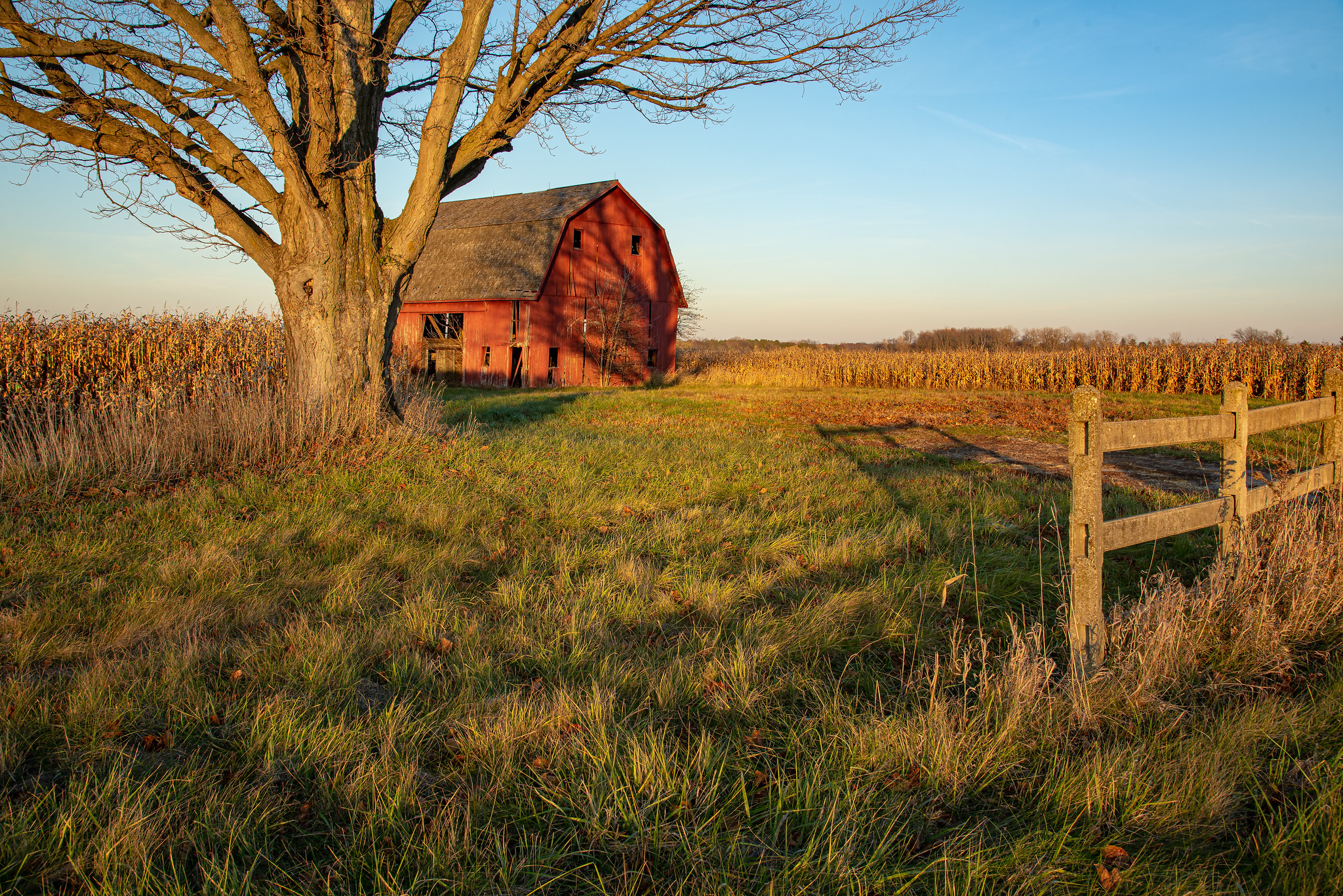
Here’s a shot of a barn near Webberville near sunset last weekend. See more in fotoman’s Barns & Old Abandoned Buildings gallery on Flickr.

Here’s a shot of a barn near Webberville near sunset last weekend. See more in fotoman’s Barns & Old Abandoned Buildings gallery on Flickr.
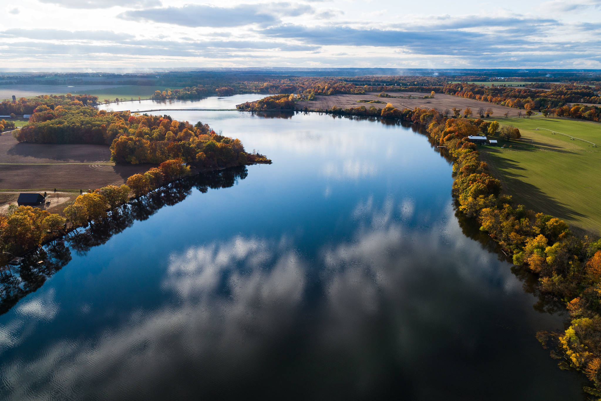
Encyclopedia Britannica says that the 210-mile-long Saint Joseph River rises near Hillsdale in south-central Michigan, flowing generally west with a swing south into northern Indiana through Elkhart and South Bend before reentering Michigan to empty into Lake Michigan at Saint Joseph and Benton Harbor. Check out places to access the St. Joseph on Michigan Water Trails.
Bill took this photo of the St Joseph River near the Langley Covered Bridge with his drone a couple of weeks ago. See more of the river & the bridge in his Michigan: St. Joseph County gallery on Flickr!
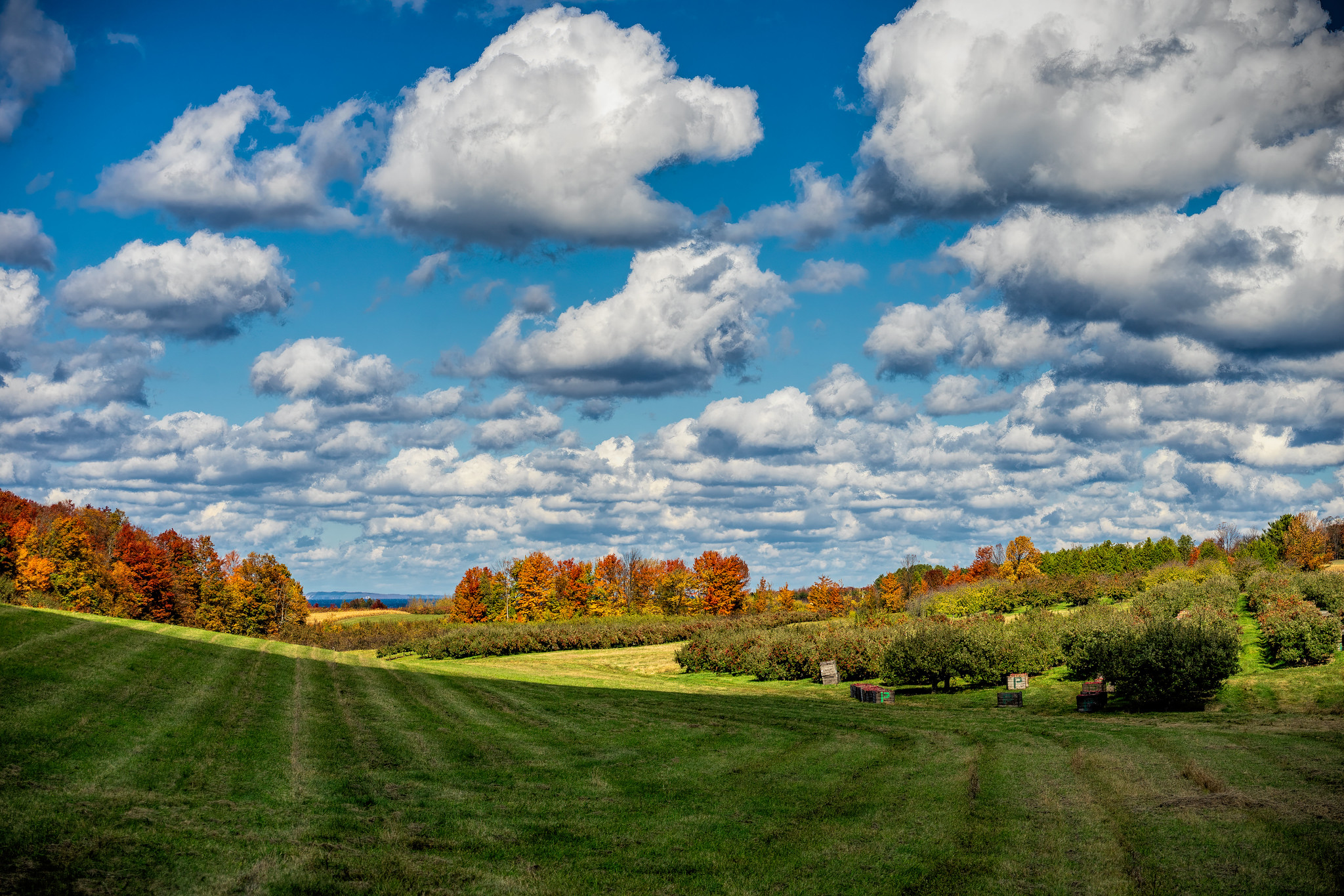
Here’s a stunning sweep of Michigan fall color by Mark Smith. Head over to Downstreamer on Flickr or follow him @downstreamer7 on Instagram for more!
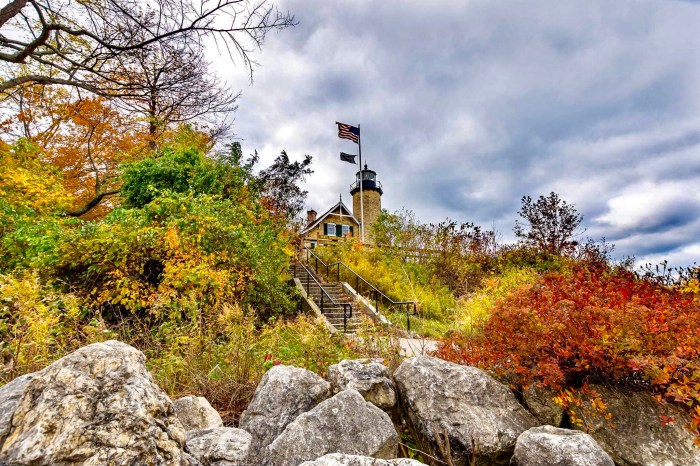
White River Light Station by cncphotos
Less than a week until Halloween, so Michigan in Pictures will feature as much Michigan spookyness as possible. Today’s story appears courtesy Still on Duty at White River Light on Absolute Michigan:
When Karen McDonnell is alone she sometimes hears footsteps on the stairway of the former White River Light. But she isn’t afraid. She says, “I like the comfort it gives me. It’s like a watchman, just making sure everything is okay before it’s too late at night.”
McDonnell is the curator of an old lighthouse that has been turned into a museum. She takes care of the light and gives tours to visitors. Sometimes early in the morning or late at night she hears what sounds like somebody climbing the stairs and walking around on the upper level. She wonders if it might be the spirit of the light’s first keeper.
When the White River Light opened in the mid-1870s, William Robinson and his wife Sarah moved in. Over the years, the English couple raised their family at Whitehall. Sarah died at a young age, but William remained the lightkeeper for 47 years. When the government forced the 87-year-old keeper to retire in 1915, William’s grandson became the next lightkeeper at White River. William helped his grandson run the light, but the rules said that only the lightkeeper and his “immediate” family could live at the lighthouse. William would have to leave. But he refused, telling his grandson, “I am not going to leave this building.” He was right. The day before he had to move out, he died. His grandson buried him in a small nearby cemetery…
Read more over on Absolute Michigan and learn more about the lighthouse at White River Light on Terry Pepper’s Seeing the Light.
Cncphotos took this last week. See more in their Lighthouses gallery on Flickr!
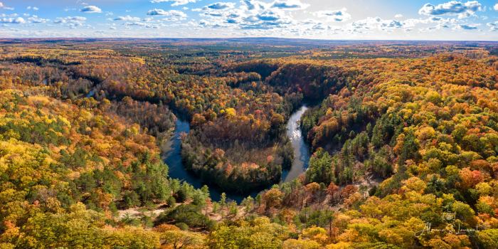
High Rollaways Horseshoe by Alanna St. Laurent
Traverse City MI explains the name for the High Rollaway, officially the Manistee River High Banks Rollaway:
The high river bluff is the reason for the area’s unusual name. At the turn of the last century, lumbermen needed inexpensive ways to transport timber from the forest to the sawmills and wide-flowing rivers like the Manistee were the answer. Steep banks were used to “rollaway” the logs in a thunderous avalanche to the water where they floated to the mills. Unfortunately, the practice quickly stripped the vegetation from the river banks and, by the time the lumbermen moved on, eroding sand was clogging and narrowing the rivers. In the last 20 years, efforts have been made to stabilize the Manistee River High Banks with fieldstone terraces and replantings. The observation platform was installed in 2001 so visitors could enjoy the stunning view without damaging the fragile system.
Alanna took this stunning photo with her drone last week. Follow her on Facebook for lots more great shots & check out her photography workshops at Creative Visions Photographic Workshops!
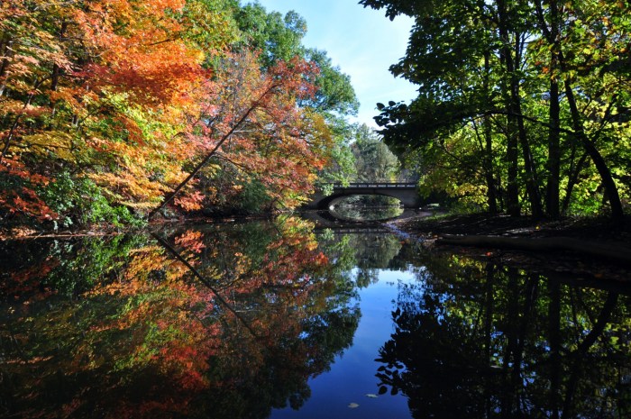
Newburgh Bridge by River Wanderer
River Wanderer shared this shot of the Newburgh Bridge along the Middle Rouge River, heading into Newburgh Lake on a beautiful day in October of 2016. See lots more on their Flickr page.
You can learn more about the Rouge River from Friends of the Rouge.
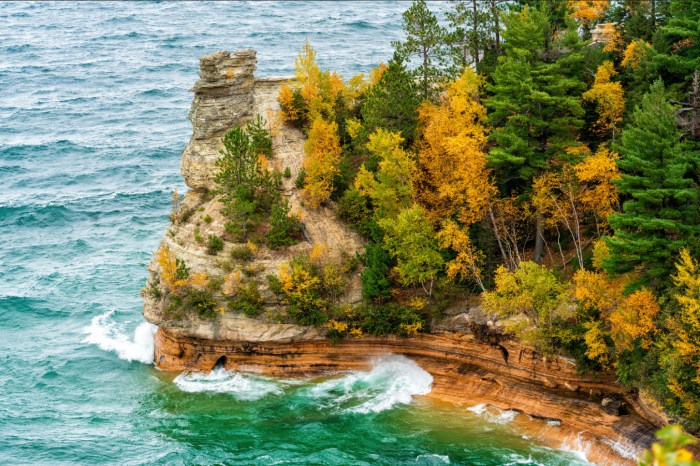
Miners Castle by Charles Bonham
I always wondered about the whole “miner” thing with Miners River/Falls/Castle in the Pictured Rocks National Lakeshore. The Miners Falls Trail Guide explains that:
Visited by passing English geologists in 1771-1772, the nearby Miners River was named by employees of Alexander Henry during one of his exploratory trips on Lake Superior. At that time, indicators or “leaders” were used to locate mineral deposits. Discolored water oozing from bedrock was one such leader found in the Miners Basin, although no minerals were ever extracted from this area.
Charles took took this pic last week. See lots more on his Flickr!
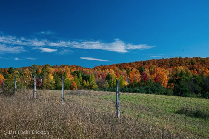
Autumn Mosaic by Lisa Flaska Erickson
“Winter is an etching, spring a watercolor, summer an oil painting and autumn a mosaic of them all.”
~Stanley Horowitz
Lisa captured this beautiful canvas of fall color near Maple City on the Leelanau Peninsula. Follow Lisa at supqueen on Instagram for lots more including some more gorgeous autumn 2020 photos!!
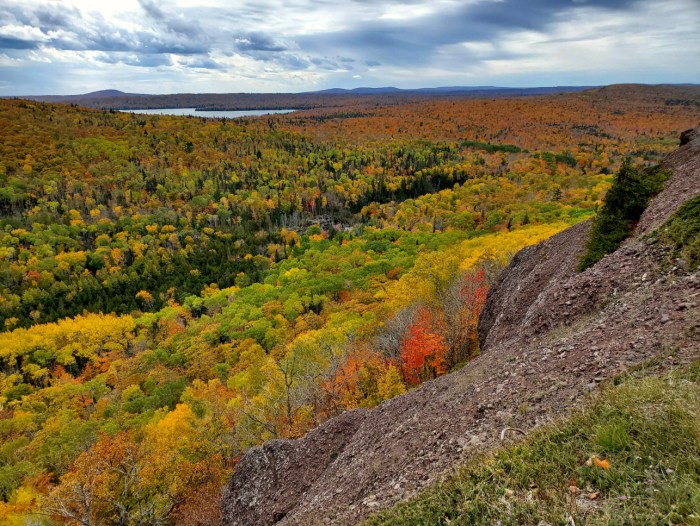
Here’s a stunning Upper Peninsula vista taken the other day from Brockway Mountain on the Keweenaw Peninsula which CopperHarbor.org says:
…is the highest paved road between the Rockies and the Alleghenies. The drive is 10 miles long and has many pull-offs enabling visitors to stop and take in the scenery. There are two nature preserves along the drive that are worth visiting too. At the top, 735 feet above Copper Harbor, you will find a breathtaking 360° view of Lake Superior, the surrounding woodlands and inland lakes. On a clear day you can see Isle Royale about 50 miles away!
See more in Troops’ Keweenaw Peninsula gallery on Flickr!