
Untitled, photo by Bill Schwab.
Check this out bigger in Bill’s Michigan slideshow.

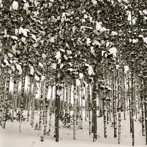
HuronFeb1-3, photo by richwyllis.
Looks like a cool campground in warmer times.
Check it out bigger or in Rich’s slideshow.

Looking Up Woodward Avenue, c 1917, photo by Detroit Publishing Company
Thanks Chris Sebok for today’s find and happy birthday to Michigan!
This dry plate glass negative comes from the Detroit Publishing Company. Check out more photos from the Detroit Publishing Company archive and purchase prints from Shorpy’s!
This photo inspired mLive to put together a fantastic photographic timeline feature they titled Photos of Detroit’s Golden Age: The other side of ‘ruin porn’. It begins:
Detroit these days is not exactly the model of a great American city. While still vibrant and beautiful in several areas, the Motor City isn’t what it used to be, and we’re not here to lie or sugarcoat it.
Those abandoned buildings that have been thrust into the world’s spotlight through photo galleries by the likes of Time and Slate are real and a major part of Detroit’s landscape today.
But a few months ago, we came across a different kind of photo from Detroit (above), one that showed the city as a bustling metropolis full of people and booming businesses — in 1917.
People seemed to love it just as much as they loved those Detroit “ruin porn” photos.
Read on (and see some video) at mLive and check the comments at Shorpy’s too!

24/365 – Quincy Boiler and Shaft, photo by dcclark.
You can buy mine related stuff and get tour information from the Quincy Mine Hoist Association. You can’t, however, get historical information.
Thankfully, David has posted a bunch. He has some information on his Copper Country Explorer web site (update: actually run by his friend Mike!). On his Cliffs & Ruins blog he writes:
In the foreground are the ruins an old boiler house — once filled with huge steam boilers, providing steam power to the mine. Behind it is the #2 shafthouse, a modern steel structure from a different era of the mine’s development.
The Quincy Mine is a very different mine from the Central Mine, featured yesterday. Although both started in the 1850s, the Central was a “fissure” mine — mining primarily huge, pure chunks of copper. The Quincy, on the other hand, was an “amygdaloid” mine — mining rock with tiny bits of copper infused through it. As it turns out, Quincy’s model was better, and all of the truly successful mines in the Copper Country were amygdaloid mines. Quincy paid dividends for nearly 50 years straight, earning it the name “Old Reliable”. But, just like the Central and all other Copper Country mines, the Quincy is now nothing more than a collection of shafts and ruins.
It’s one of the Keweenaw National Heritage Sites and there’s detailed information on Wikipedia’s Quincy Mine entry.
Be sure to check this out bigger, in David’s store and on his Quincy, Michigan map.

US-27 In Michigan, photo by U.S. Highway 12
Ronnie writes:
For 76 years, from 1926-2002, US-27 was a primary highway in the state of Michigan. During the Postwar highway expansion era on the even of the Interstate Highway system, US-27 was extended to St. Ignace, Michigan, across the Mackinac Bridge. However, as I-75 was completed in sections north of Tri-Cities area, US-27 was eventually truncated to just north of Higgins Lake in 1961.
As Interstate 69 was completed in the 1970s around the Charlotte area, US-27 was moved onto the new Interstate freeway. In 1991, MDOT petitioned AASHTO, to have US-27 removed from the state of Michigan’s highway network. This request was denied because MDOT made no mention of their plans for US-27 north of Lansing. However, eight years later on in 1999, they submitted another application, and AAHSTO approved the request to truncate US-27 from south of Grayling to Fort Wayne, Indiana. The end finally came in 2002, when all of the old US-27 marker signs were removed.
When I think of US-27 and the many other U.S. Highways in Michigan, this two-lane photo from the Michigan State Highway Dept. comes to mind. This image was shot in Clare County, near the community of Harrison during Labor Day in 1955. I can just image driving along this hilly and winding highway at 105 km/h (65 mph), and having a deer run standing in the roadway as I crested the hill.
Image from the Michigan State Highway Dept. (MDOT) and is in the public domain.
Looking for more? Check out the US-27 group slideshow on Flickr and US Route 27 on Wikipedia.

Lansing (Mich.) , photo courtesy Seeking Michigan
I saw this photo of a winter’s day in Lansing in the mid 1930s when I found the photo of the Soo last week. The old cars and the chill wind made me think about how folks in Michigan were probably feeling at the time. This was the depths of the Great Depression, when the Civilian Conservation Corps sought to engage young men in meaningful work, when the UAW was founded and the workers in Flint held their famous sit-down strike – a period of wrenching change for Michigan and the nation.
Probably no time until the present day featured so many people whose way of life had vanished, leaving so much in the way of challenge and so little hope in front of them.
Still, from those dark days Michigan climbed to previously unthinkable heights, led by entrepreneurs, bold leaders and a citizenry that was willing to work hard to realize their dreams.
I hope that gives you the same measure of hope that it gives me.
You can see this photo bigger if you click through and choose “Printable Version”.

Sault Ste. Marie, Michigan,photo courtesy Seeking Michigan
This photo was taken by an unknown person on an unknown winter day on Water Street in Sault Sainte Marie. Wikipedia says that Sault Ste. Marie is the county seat of Chippewa County and the second most populous city in the Upper Peninsula.
Founded as a mission in 1668 by Father Jacques Marquette, Sault Ste. Marie is the oldest European settlement in the Midwest. A fur trading settlement soon grew up at this crossroads on both banks of the river, making the area the center of the 3,000-mile fur trade route extending west from Montreal to the Sault, then to the country north of Lake Superior.
The town was split into two in 1797, when the Upper Peninsula was transferred from the province of Upper Canada to the United States.
Sault Sainte Marie is Old French for “falls of St. Mary” (Sault de Sainte Marie), a reference to the rapids in the St. Marys River, which joins Lake Superior to Lake Huron. The spelling Sault-Sainte-Marie is more usual in French, but the name is written without hyphens in English. Both cities and the vicinity as a whole are often referred to as the Sault or the Soo.
You can learn more about the Soo from the Sault Ste. Marie Visitors Bureau and see a boatload of old photos from Sault Sainte Marie from Seeking Michigan.

Schrunchsicle, photo by The ClayTaurus.
Check this out bigger and in Chris’s Other’s Favorites set (slideshow).
Here’s the icicle slideshow from the Absolute Michigan pool.

Lines, photo by Ralph Krawczyk Jr.
If you don’t know Ralph, you should.
Be sure to check it out bigger or in his Digital Goodness slideshow.

Mackinac MI UP Great Lakes Passenger and Auto Ferry City of Munising connecting Mackinaw City and St Ignace before the Mackinaw Bridge was built, photo by UpNorth Memories – Donald (Don) Harrison.
Before the Mackinac Bridge was built (check Absolute Michigan for lots more on that), going to or from the UP was by ferry. The City of Munising was the last of the breed:
Built by the American Ship Building Company of Cleveland in 1903 for the Pere Marquette Railway Company, the “Pere Marquette 20” became the “City of Munising” in 1937. The Michigan Department of Highways used the ship to ferry autos across the Straits of Mackinac until 1959. The ship was used for potato storage by a Washington Island, Wisconsin firm until 1973.
Michigan State Ferry Album has some photos of the City of Munising and other ships that plied the Straits.
Check this out bigger and see some shots of the old ferry docks in Don’s slideshow of old Mackinac photos
