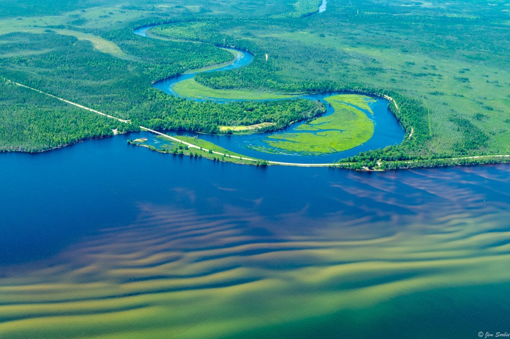
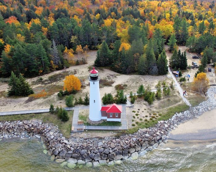
The river is best known for the Tahquamenon Falls, a succession of two waterfalls in Tahquamenon Falls State Park totalling approximately 73 feet (22 m) in height. Because the headwaters of the river are located in a boreal wetland that is rich in cedar, spruce and hemlock trees, the river’s waters carry a significant amount of tannin in solution (i.e., it is a blackwater river), and are often brown or golden-brown in color. The Tahquamenon Falls are thus acclaimed as being the largest naturally dyed or colored waterfall in the United States.
The meaning of “Tahquamenon” is not known. Some called it the “River of the Head Winds” because they bucked the wind on the lower river no matter what direction they were paddling. Others called it the “River of a Hundred Bends”. Twentieth century descendants of local Chippewa translated the name to mean “river up against a hill” or “lost river island” or “river with an island part way”. In 1930 Jesuit scholar, Father William Gagnieut, concluded that the meaning of the name had been lost.
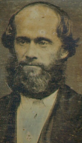
On July 8th, 1850, James Jesse Strang was crowned king of Beaver Island. Michigan History Magazine shared this article with me years ago:
Despite claiming to be “the perfect atheist,” Strang became a follower of Mormon leader Joseph Smith. When Smith was murdered in March 1844, Strang claimed to be the new Mormon leader, although most Mormons followed Brigham Young to Utah.
King James Strang (daguerreotype, 1856)
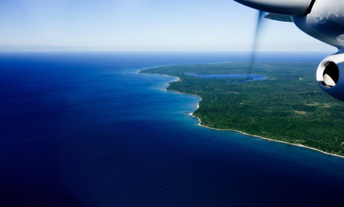
Strang’s followers settled on an uninhabited island in northern Lake Michigan they called Big Beaver. The island had everything Strang and his followers needed: virgin timber, tillable land, a deep and sheltered bay and exceptional offshore fishing. It also was twenty-five miles off the mainland-a perfect place to protect Strang’s followers from outside influences and beliefs.
By the mid-1850s, the Mormon colony on Beaver Island boasted more than 2,500 followers. Beaver Island replaced Mackinac Island as the principal refueling stop for steamers, and the annual value of the kingdom’s exports (fish, wood and potatoes) was considerable.
The growth of Strang’s kingdom was not without controversy. Non-Mormons, called Gentiles, took exception with the Mormon settlement. Driven from the area’s fishing spots, angry over the establishment of a kingdom and Strang’s adoption of the practice of polygamy, the Gentiles vowed revenge. At the bequest of President Millard Fillmore, the U.S. district attorney prosecuted Strang for an assortment of unfounded offenses that included murder and treason. However, Strang was acquitted on all charges, and a year later he was overwhelmingly elected to the state legislature.
Strang ruled Beaver Island as an autocrat; he even had himself crowned king. But regulating every aspect of his followers’ lives led to his downfall. Describing women’s clothes as impractical and unhealthy, Strang decreed female subjects needed to dress in loose, knee-length smocks worn over modest pantaloons. Most Beaver Island women accepted the change, but a few refused to comply. When two women refused to wear pantaloons, Strang had their husbands whipped. The two men sought revenge and on June 16, 1856, they ambushed and shot their king.
On July 9, 1856, James Jesse Strang died from his wounds. He was buried in Wisconsin.
With Strang gone, enraged Gentiles charged onto Beaver Island and evicted the Mormons. After taking control of the Mormon printing office, the attackers printed a manifesto that boasted, “The dominion of King Strang is at an end.”
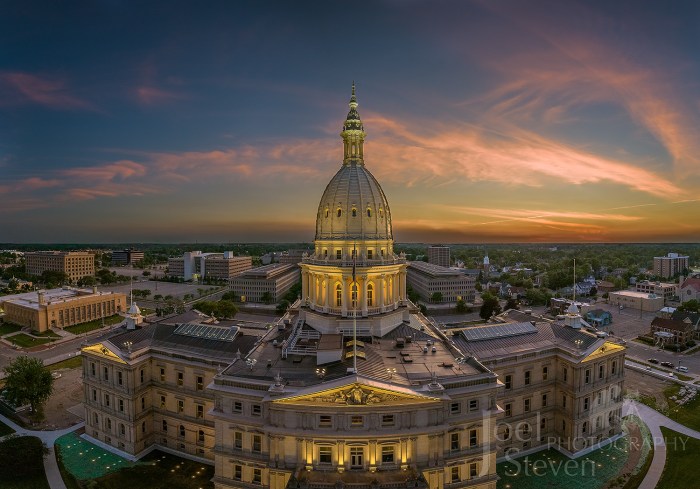
In January 1872, a plan (called “Tuebor,” meaning, “I will defend”) submitted by architect Elijah E. Myers of Springfield, Illinois, was selected. Myers moved to Michigan to supervise construction and lived for the rest of his life in his adopted state.
Construction began in 1872. When the cornerstone of the eagerly-awaited building was laid on October 2, 1873, a ceremony was held which rivaled anything Lansing had seen since becoming the capital a quarter of a century earlier. People thronged to the city in numbers far exceeding its capacity. Private citizens opened their homes and made preparations to feed and shelter the visitors.
Materials for the building came from all over the country and even from abroad. Although the millions of bricks that make up its walls and ceilings were locally made in Lansing, the stone facade came from Ohio, the cast iron for the dome and floor beams from Pennsylvania, and the marble and limestone floors from Vermont. The Board of Commissioners made sure the best materials were selected for the best price—wherever they could be found. The final cost totaled $1,427,738.78, considered modest for the construction of a state capitol during this period.
How about those blues??!! The Michigan DNR says that Clear Lake State Park in Montmorency County is located within the Mackinaw State Forest and:
…is a quiet, secluded retreat offering a sandy beach and a shallow swimming area that is ideal for children. A metal detecting area is available. The park encompasses two-thirds of the Clear Lake’s shoreline. A trail spur offers Off-Road Vehicle (ORV) riders a direct connection to the Atlanta ORV route and the Michigan Cross Country Cycle Trail.
This State Forest is composed of the northern eight counties of the Lower Peninsula. The Atlanta area of this forest contains over 258,000 acres of state-owned public land. Most of the virgin timber was removed from the forest by the 1920s and has been replaced by second-growth forests managed by the DNR. Deer, elk, turkey and small game are plentiful in the Mackinaw State Forest …elk can be seen and heard throughout the area in the early morning and evening, especially during the spring and fall. Native elk disappeared from Michigan nearly 100 years ago, they were reintroduced in 1918 and have multiplied into a large herd.
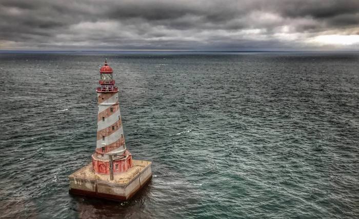
A reader shared a link to this photo with me, and this weekend I met a woman whose husband is a mechanic for the helicopter that took this photo. I thought that was pretty cool, but I also was putting groceries in my car at the local Meijer and a van pulled in a couple of slots down with a “White Shoal Light Historical Preservation Society” logo on it! I talked for a bit with Brent who’s heading up the group, and I expect to have updates and photos as they get going with their renovation!
I also noticed that the photo from back in 2009 I had of this light has been removed by the photographer, so here’s the skinny on one of Michigan’s most recognizablelight houses. White Shoals are located 20 miles east of Mackinac Point and just northwest of Waugoshance Island. So shallow that they break the surface in places, they long presented a hazard to navigation for ships entering the Straits of Mackinac. On his White Shoal Lighthouse page, Terry Pepper relates that beginning in October of 1891, the Lightship LV56 anchored at White Shoal during the shipping season for 19 years. Finally in 1907 funds were appropriated for a permanent lighthouse:
Spring of 1908 saw work begin on the White Shoal light on two separate fronts. While a crew at the site leveled a one hundred and two-foot square area on the shoal through the addition and careful placement of loads of stone, a second crew worked on building a timber crib on shore at St. Ignace. Seventy-two feet square and eighteen and a half feet high, the huge crib contained 400,000 square feet of lumber, and on completion was slowly towed out to the shoal and centered over the leveled lake bottom. Once in location, the crib was filled with 4,000 tons of stone until it sank to a point at which its uppermost surface was level and two feet below the water’s surface.
On top of this crib, a seventy-foot square stone block base was constructed to a total height of four feet, with the remainder of the pier being of poured concrete atop the block base. With the base complete, an acetylene-powered lens lantern was installed atop a temporary steel skeletal tower on December 5th, and with the onset of winter storms, work at the shoal ended for the season.
Seeing the Light has much more about the construction and history of White Shoal Light including shots of the tower and crib under construction and information about lighthouse tours offered by Shepler’s Ferry, on which you can see White Shoal, Waugoshance and Gray’s Reef Lights.
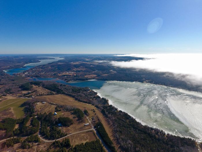
Here’s a look at North & South Lake Leelanau with “The Narrows” in between. I live just off the right edge of this picture and thought it was pretty cool how the spring fog completely covered Lake Michigan in this picture, creating a lake of fog!
“A lake is the landscape’s most beautiful and expressive feature. It is the earth’s eye; looking into which the beholder measures the depth of his own nature.” —Henry David Thoreau, Walden
One of Thoreau’s most beautiful thoughts in my mind, and we are certainly blessed in Michigan to have the eyes of the earth upon us here as they are in few other places.
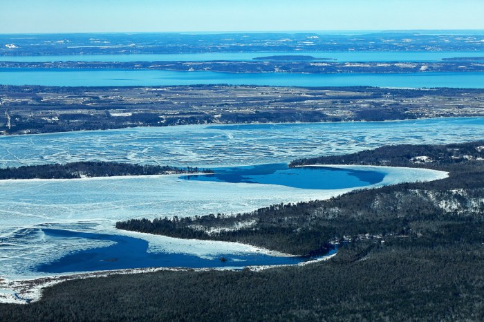
Sandy says that at the top of the photo are West & East Grand Traverse Bay and then Elk Lake and Lake Skegemog. You can get your bearings and have a little fun exploring the lakes from above in this 3d view from Google Earth.
Terry Pepper’s Seeing the Light says that Crisp Point Lighthouse is located on the Lake Superior coastline between Whitefish Point and Grand Island. It’s one of the most beautiful stretches of shoreline in all of the Midwest and:
It is difficult to imagine that during the 1800’s this stretch of seemingly bucolic coastline was known to mariners as “The Shipwreck Coast,” with the hulks of innumerable vessels pushed onto the shore by violent storms out of the north, or lost in the pea soup fogs which frequently enveloped the area.
Since the early 1850’s, the Lighthouse Board had been working on establishing a series of Lights to guide mariners along this treacherous stretch, with Lights established at Whitefish Point in 1848, Grand Island in 1867, Big Sable Point in 1874 and Grand Marais in 1895. As further witness to the dangers represented by this stretch of coastline, Congress approved the establishment of four life saving stations between Vermilion and Deer Park on June 20, 1874, one of which was designated as Station Ten, and built at an unnamed point approximately fifteen miles west of Whitefish Point. Although David Grummond was appointed as the first keeper at life saving station 10, it would be Christopher Crisp who served as keeper from 1878 until 1890 who would have the most lasting impact on the area, as Crisp became so well known that the point on which the station was established would become forever known as “Crisp’s Point.”
…The station was officially decommissioned in 1994, and without keepers maintaining the protective piers, shoreline erosion had progressed to the point that the lake was lapping at the very base of the tower itself. After the brick service room collapsed in November 1996, the GSA feared that the tower itself was in danger of toppling, and not wishing the responsibility and cost of stabilizing or demolishing the tower, the property was scheduled for auction in 1997.
Ohio visitors Don and Nellie Ross came across the old station, and taken with the natural beauty and history of the location, partnered with a number of area residents to form the Crisp Point Lighthouse Preservation Society, with their charter being the restoration and long term survival of what was left of the station.
Read on for lots more and historical photos. Terry adds that a visit to Crisp Point is a “must” for any lighthouse fans, as it remains one of the most desolate and beautiful locations in all of the Great Lakes. More about the lighthouse and its preservation at crisppointlighthouse.org.
This wonderful photo made me want to know more about Houghton, Michigan, so here’s an edited profile of Houghton via Wikipedia:
Houghton is located on the south shore of Portage Lake, across from Hancock. (see map) Native Americans mined copper in and around what would later be Houghton thousands of years before European settlement. French explorers had noted its existence in the area as early as the seventeenth century, and in 1772 Alexander Henry had prospected for copper on the Ontonagon River near Victoria. When Horace Greeley said, “Go West, young man” he wasn’t referring to gold, but rather the copper rush in Michigan’s western Upper Peninsula.
The city is named after Douglass Houghton, physician-naturalist on Henry Rowe Schoolcraft’s Lake Superior expedition whose 1841 report on the quantity and superior qualities of UP copper earned him the title of “father of copper mining in the United States.” The news brought many Cornish and Finnish immigrants to the area, along with smaller numbers of French-Canadian immigrants arrived in Houghton (or Copper Island as they called it) to work in the copper mines. These groups have had and continue to have a great influence on the area’s culture and cuisine.
In Houghton’s first days it was said that “only thieves, crooks, murderers and Indians” lived there. The post Civil War boom and increasing demand for copper wiring fueled the development of Houghton in the 1860s and 1870s. The Keweenaw Waterway, a dredging and extension of the Portage Lake, the Portage Shipping Canal and Lily Pond that turned the northern part of the Keweenaw Peninsula into “Copper Island” was completed in 1873. By 1880 Houghton had become “a burgeoning city” and in 1883, the railroad was extended from Marquette.
The last nearby mines closed in the late 1960s, but in 1885 the Michigan State Legislature foundedthe Michigan College of Mines to teach metallurgy and mining engineering. The school continues today as Michigan Technological University – the primary employer in the city.
Houghton has the distinction of being the birthplace of professional ice hockey in the United States when the Portage Lakers were formed in 1903, and Houghton’s Dee Stadium (formerly the Amphidrome) is the home of the Portage Lake Pioneers Senior Hockey Team.
Click for more from Wikipedia and please feel free to share tidbits in the comments.
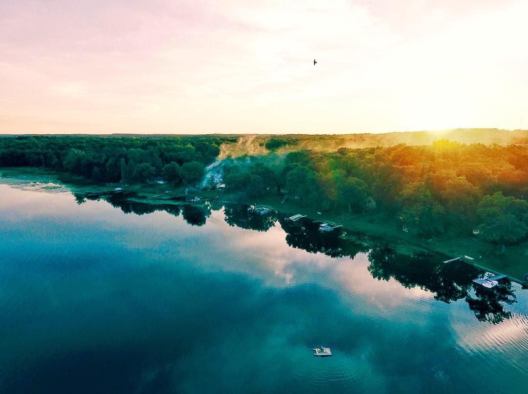
This photo was taken at Crispell Lake in Clarklake, MI on a calm, summer evening. I couldn’t capture the sun rays from where I was standing, so it seemed like a perfect opportunity to get out my new drone. There were only a couple boats on the lake and it was a nice quiet night. When I was capturing this scene it just so happened that a bird flew into the frame at the perfect moment.
Crispell Lake is located in Jackson County, Michigan. This lake is 82 acres in size. It is approximately 25 feet deep at its deepest point. Anglers can expect to catch a variety of fish including Black Crappie, Bluegill, Brown Trout, Grass Pickerel, Largemouth Bass, Sunfish, Walleye and Yellow Perch.


